
MyTopo
Keys Creek Oregon US Topo Map
Couldn't load pickup availability
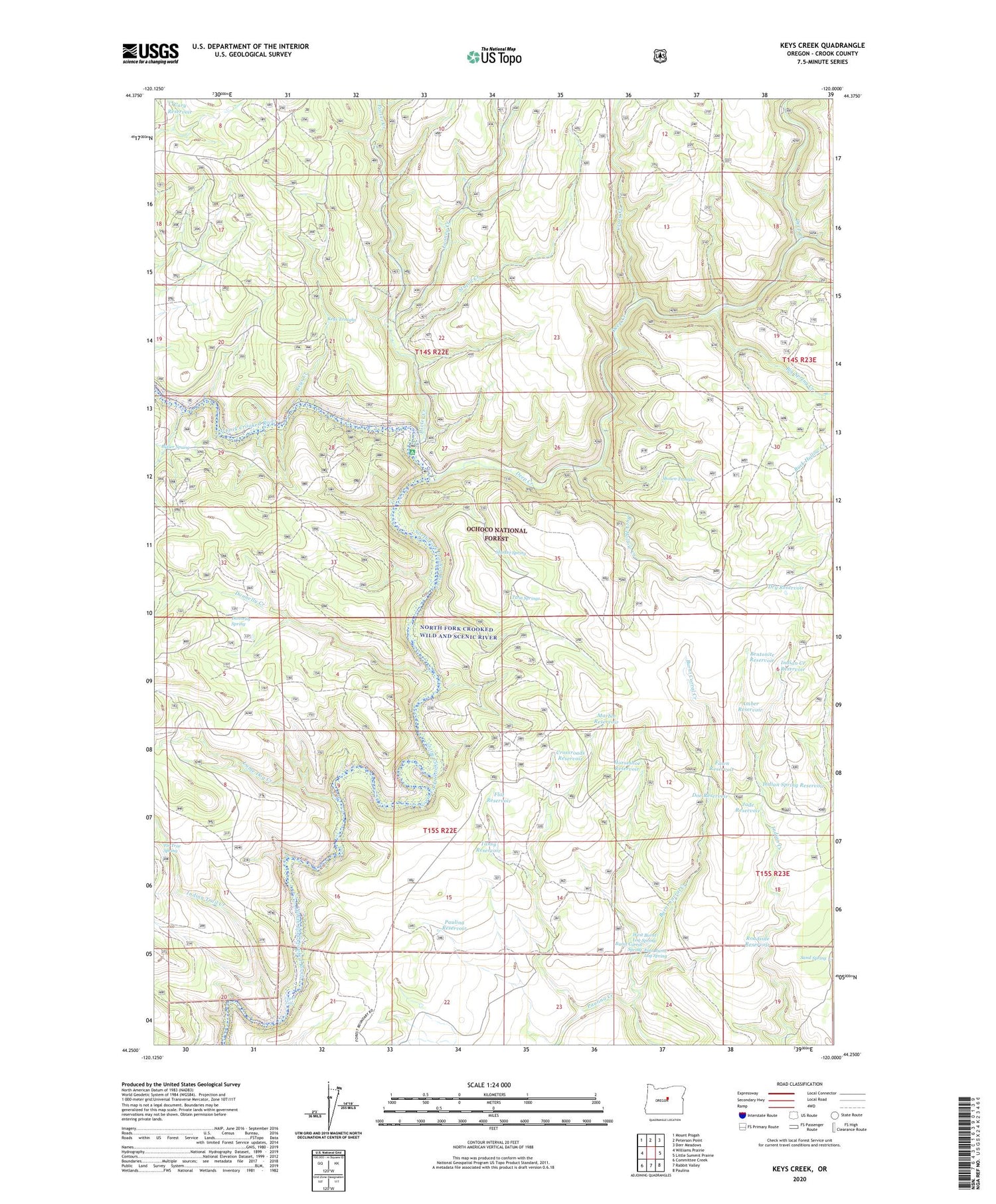
2020 topographic map quadrangle Keys Creek in the state of Oregon. Scale: 1:24000. Based on the newly updated USGS 7.5' US Topo map series, this map is in the following counties: Crook. The map contains contour data, water features, and other items you are used to seeing on USGS maps, but also has updated roads and other features. This is the next generation of topographic maps. Printed on high-quality waterproof paper with UV fade-resistant inks.
Quads adjacent to this one:
West: Williams Prairie
Northwest: Mount Pisgah
North: Peterson Point
Northeast: Derr Meadows
East: Little Summit Prairie
Southeast: Paulina
South: Rabbit Valley
Southwest: Committee Creek
Contains the following named places: Amber Reservoir, Bentonite Reservoir, Big Spring Creek, Buck Hollow Creek, Burnt Corral Creek, Burnt Corral Spring, Butler Spring, Cary Reservoir, Charity Reservoir, Cinch Reservoir, Connell Reservoir, Crazy Creek, Cross Reservoir, Crossroads Reservoir, Deep Creek, Deep Creek Recreation Site, Doe Reservoir, Donnelly Creek, Donnelly Spring, Dry Reservoir, East Burnt Log Spring, Fawn Reservoir, Fir Tree Spring, Flat Reservoir, Horseshoe Reservoir, Indian Creek Reservoir, Indian Spring Reservoir, Indian Trail Creek, Jade Reservoir, Keys Creek, Keys Troughs, Lame Dog Creek, Little Summit Creek, Looney Creek, Marble Reservoir, Market Spring, Paulina Reservoir, Pine Reservoir, Porter Creek, Roadside Reservoir, Sand Spring, Shale Reservoir, Shown Troughs, Stupid Creek, Tansy Reservoir, Twin Springs, Twin Springs Campground, Twin Springs Reservoir, Upper Falls, West Burnt Log Spring


