MyTopo
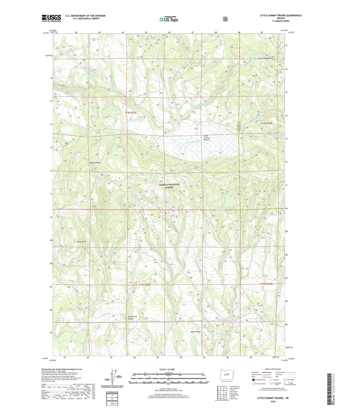
Little Summit Prairie Oregon US Topo Map
Couldn't load pickup availability
Also explore the Little Summit Prairie Forest Service Topo of this same quad for updated USFS data
2023 topographic map quadrangle Little Summit Prairie in the state of Oregon. Scale: 1:24000. Based on the newly updated USGS 7.5' US Topo map series, this map is in the following counties: Crook, Wheeler. The map contains contour data, water features, and other items you are used to seeing on USGS maps, but also has updated roads and other features. This is the next generation of topographic maps. Printed on high-quality waterproof paper with UV fade-resistant inks.
Quads adjacent to this one:
West: Keys Creek
Northwest: Peterson Point
North: Derr Meadows
Northeast: Antone
East: Six Corners
Southeast: Mud Spring
South: Paulina
Southwest: Rabbit Valley
This map covers the same area as the classic USGS quad with code o44119c8.
Contains the following named places: Bee Reservoir, Big Spring, Big Springs Recreation Site, Bog Spring, Camp Reservoir, Corral Reservoir, Dozer Spring, Dublin Spring, Hewed Log Spring, Higgins Spring, Hook Reservoir, Little Summit Campground, Little Summit Prairie, Marg Lake, Meadow Reservoir, Minifie Ridge, Morgan Reservoir, Ochoco National Forest, Paulina Butte, Paulina Spring, Post Spring, Quicksand Spring, Roba Butte, Roba Spring, Round Meadow, Ruby Reservoir, Stump Spring, Thornton Creek, Timothy Meadow, Wasp Reservoir, West Thornton Creek, Wilson Spring