MyTopo
Derr Meadows Oregon US Topo Map
Couldn't load pickup availability
Also explore the Derr Meadows Forest Service Topo of this same quad for updated USFS data
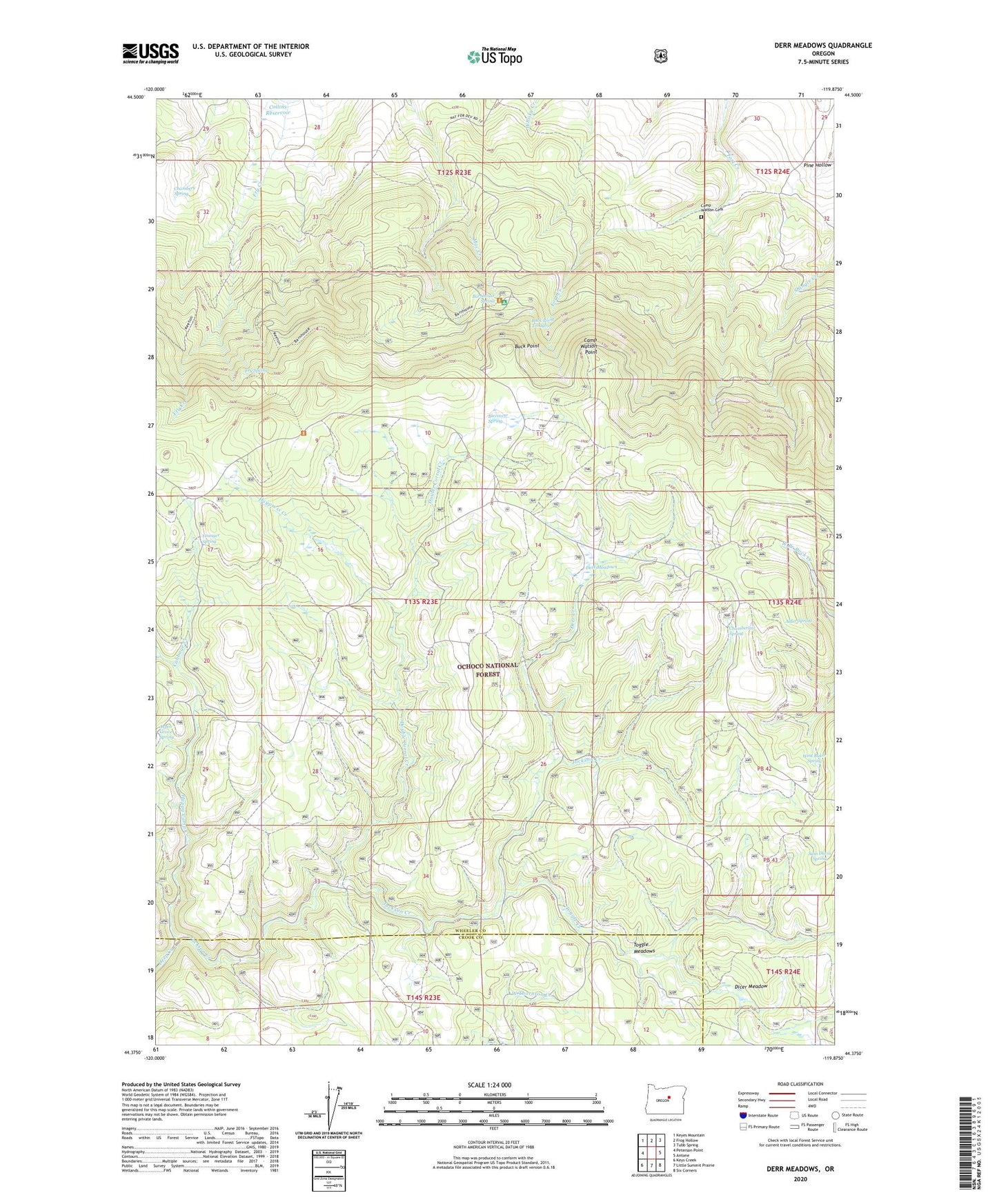
2023 topographic map quadrangle Derr Meadows in the state of Oregon. Scale: 1:24000. Based on the newly updated USGS 7.5' US Topo map series, this map is in the following counties: Wheeler, Crook. The map contains contour data, water features, and other items you are used to seeing on USGS maps, but also has updated roads and other features. This is the next generation of topographic maps. Printed on high-quality waterproof paper with UV fade-resistant inks.
Quads adjacent to this one:
West: Peterson Point
Northwest: Keyes Mountain
North: Frog Hollow
Northeast: Tubb Spring
East: Antone
Southeast: Six Corners
South: Little Summit Prairie
Southwest: Keys Creek
This map covers the same area as the classic USGS quad with code o44119d8.
Contains the following named places: Alder Spring, Aspen Grove Spring, Barnhouse Recreation Site, Barnhouse Spring, Blevins Spring, Buck Point, Buck Point Troughs, Cabbage Creek, Camp Watson, Camp Watson Cemetery, Camp Watson Point, Camp Watson Post Office, Chamberlin Spring, Chambers Spring, Derr Camp, Derr Creek, Derr Guard Station, Derr Meadows, Dicer Meadow, Double Corral, Double Corral Creek, Fry Spring, Happy Camp Creek, Happy Jack Camp, Haypress Creek, Jackson Creek, Sam Davis Spring, Toggle Creek, Toggle Meadows, West Buker Spring, Younger Spring