MyTopo
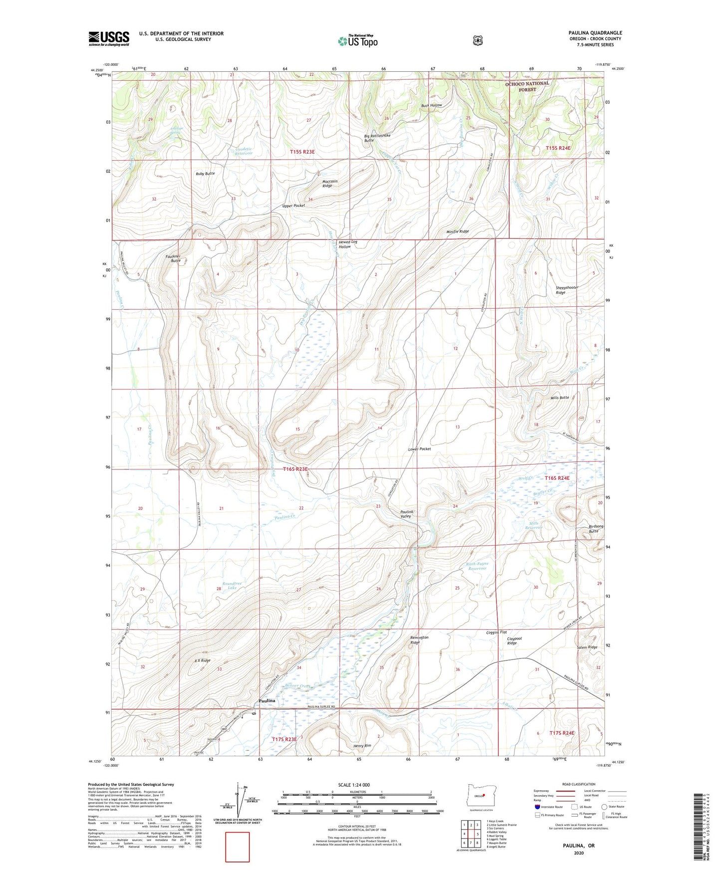
Paulina Oregon US Topo Map
Couldn't load pickup availability
Also explore the Paulina Forest Service Topo of this same quad for updated USFS data
2023 topographic map quadrangle Paulina in the state of Oregon. Scale: 1:24000. Based on the newly updated USGS 7.5' US Topo map series, this map is in the following counties: Crook. The map contains contour data, water features, and other items you are used to seeing on USGS maps, but also has updated roads and other features. This is the next generation of topographic maps. Printed on high-quality waterproof paper with UV fade-resistant inks.
Quads adjacent to this one:
West: Rabbit Valley
Northwest: Keys Creek
North: Little Summit Prairie
Northeast: Six Corners
East: Mud Spring
Southeast: Angell Butte
South: Maupin Butte
Southwest: Liggett Table
This map covers the same area as the classic USGS quad with code o44119b8.
Contains the following named places: Alkali Creek, Antelope Spring, Big Rattlesnake Butte, Birdsong Butte, Buck Hollow, Camp Dahlgren, Claypool Ridge, Coggins Flat, Congleton Ranch, Dipping Vat Creek, Dry Paulina Creek, Faulkner Butte, Ferian Ranch, Geodetic Reservoir, Henry Rim, Hewed Log Creek, Hewed Log Hollow, Lower Pocket, Mills Butte, Mills Reservoir, Minifie Ranch, Moccasin Ridge, North Wolf Creek, Paulina, Paulina Creek, Paulina Elementary School, Paulina Post Office, Paulina Valley, Remington Ridge, Ritch-Fayne Reservoir, Roundtree Lake, Ruby Butte, Sartain Ranch, Sheep Shooter Tree, Sheepshooter Ridge, Upper Pocket, Widow Creek, Wolf Creek, X X Ridge