MyTopo
Krag Peak Oregon US Topo Map
Couldn't load pickup availability
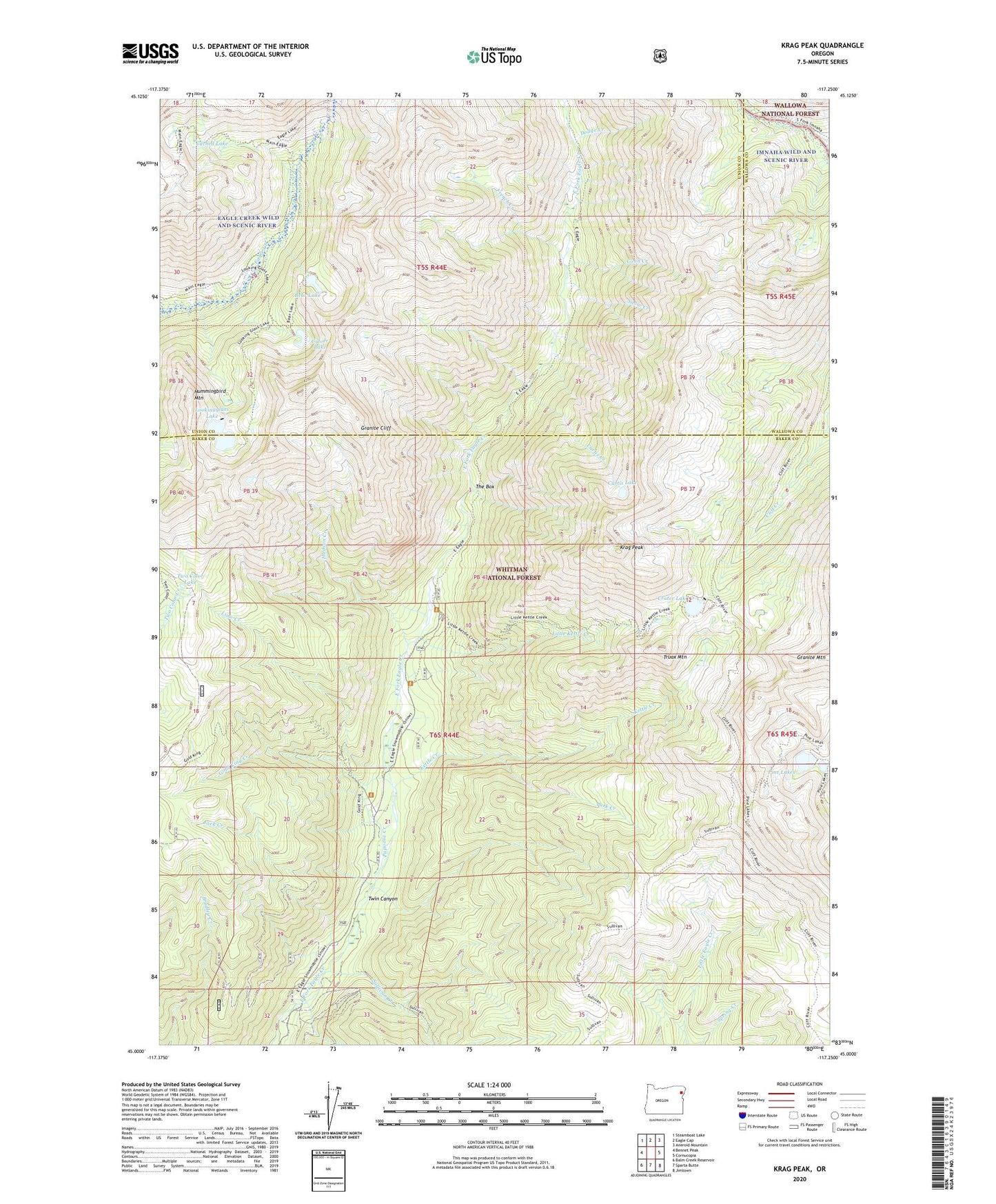
2020 topographic map quadrangle Krag Peak in the state of Oregon. Scale: 1:24000. Based on the newly updated USGS 7.5' US Topo map series, this map is in the following counties: Baker, Union, Wallowa. The map contains contour data, water features, and other items you are used to seeing on USGS maps, but also has updated roads and other features. This is the next generation of topographic maps. Printed on high-quality waterproof paper with UV fade-resistant inks.
Quads adjacent to this one:
West: Bennet Peak
Northwest: Steamboat Lake
North: Eagle Cap
Northeast: Aneroid Mountain
East: Cornucopia
Southeast: Jimtown
South: Sparta Butte
Southwest: Balm Creek Reservoir
Contains the following named places: Bear Lake, Bradley Creek Mine, Cached Lake, Coon Creek, Crater Lake, Crater Lake Dam, Culver Lake, Curtis Creek, Curtis Lake, Dodge Creek, East Eagle Mine, East Eagle Trailhead, French Creek, Gold King Creek, Granite Cliff, Hudson Creek, Hummingbird Mountain, Jack Creek, Kettle Creek, Krag Peak, Lawson Creek, Lime Creek, Little Kettle Creek, Lookingglass Lake, Lookingglass Lake Dam, Lower Pine Lake, Lower Pine Lake Dam, Main Creek Trail, Papoose Creek, Park Creek, Pine Lakes, Snow Creek, Sullivan Creek, The Box, Truax Mountain, Twin Canyon, Two Color Lake, Upper Pine Lake, Upper Pine Lake Dam