MyTopo
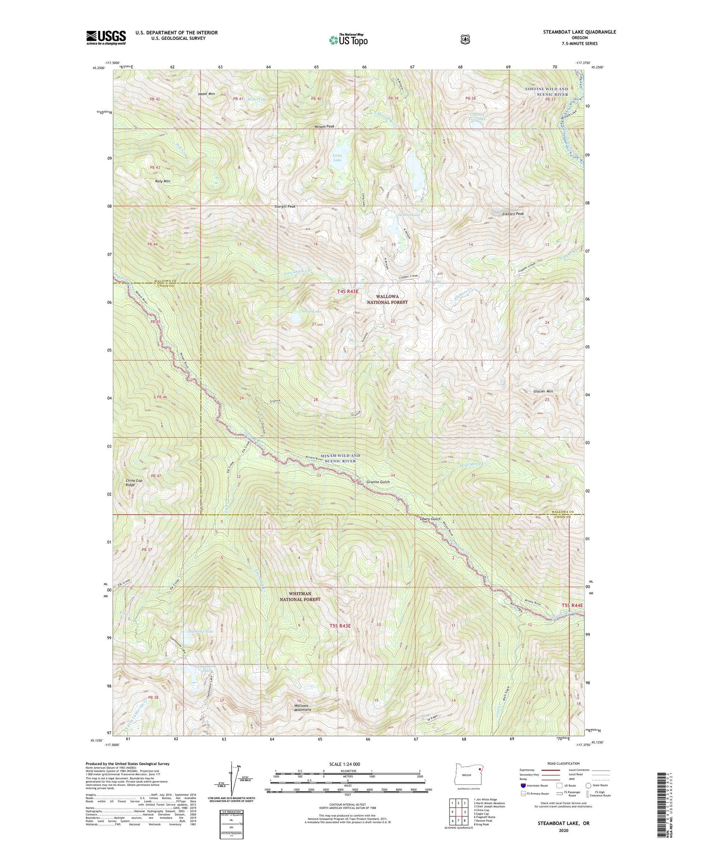
Steamboat Lake Oregon US Topo Map
Couldn't load pickup availability
Also explore the Steamboat Lake Forest Service Topo of this same quad for updated USFS data
2024 topographic map quadrangle Steamboat Lake in the state of Oregon. Scale: 1:24000. Based on the newly updated USGS 7.5' US Topo map series, this map is in the following counties: Wallowa, Union. The map contains contour data, water features, and other items you are used to seeing on USGS maps, but also has updated roads and other features. This is the next generation of topographic maps. Printed on high-quality waterproof paper with UV fade-resistant inks.
Quads adjacent to this one:
West: China Cap
Northwest: Jim White Ridge
North: North Minam Meadows
Northeast: Chief Joseph Mountain
East: Eagle Cap
Southeast: Krag Peak
South: Bennet Peak
Southwest: Flagstaff Butte
This map covers the same area as the classic USGS quad with code o45117b4.
Contains the following named places: Catched Two Lake, Cheval Lake, Copper Creek Trail, Diamond Lake, Eagle Cap Wilderness, East Fork Elk Creek, Elk Creek, Elkhorn Creek, Elkhorn Peak, Glacier Mountain, Granite Gulch, Hazel Lake, Hazel Mountain, Katy Mountain, Last Chance Creek, Long Lake, Lowry Gulch, Minam Peak, Sky Lake, Steamboat Lake, Sturgill Peak, Swamp Lake, Tombstone Lake, Trail Creek, Wild Sheep Creek