MyTopo
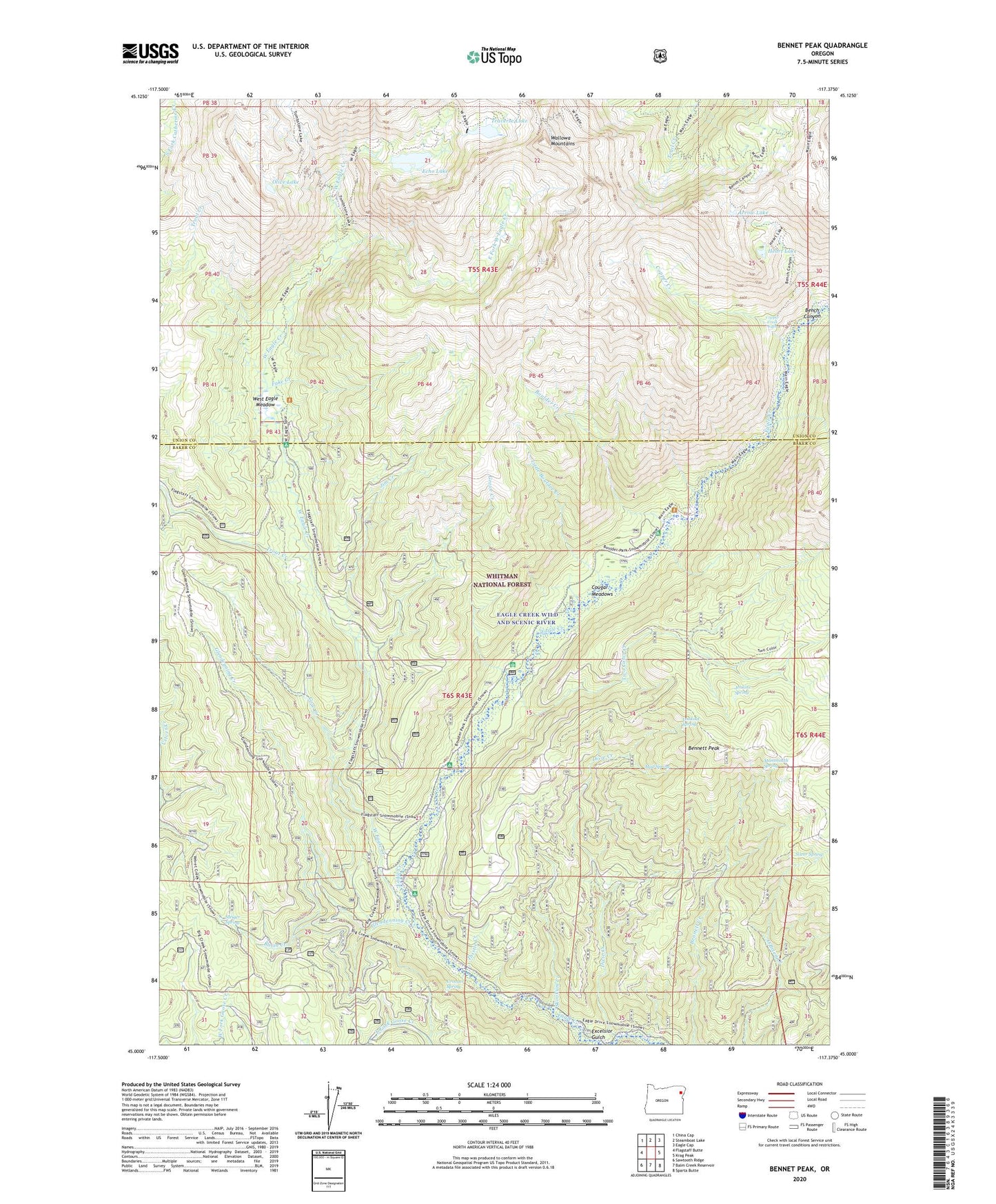
Bennet Peak Oregon US Topo Map
Couldn't load pickup availability
Also explore the Bennet Peak Forest Service Topo of this same quad for updated USFS data
2024 topographic map quadrangle Bennet Peak in the state of Oregon. Scale: 1:24000. Based on the newly updated USGS 7.5' US Topo map series, this map is in the following counties: Baker, Union. The map contains contour data, water features, and other items you are used to seeing on USGS maps, but also has updated roads and other features. This is the next generation of topographic maps. Printed on high-quality waterproof paper with UV fade-resistant inks.
Quads adjacent to this one:
West: Flagstaff Butte
Northwest: China Cap
North: Steamboat Lake
Northeast: Eagle Cap
East: Krag Peak
Southeast: Sparta Butte
South: Balm Creek Reservoir
Southwest: Sawtooth Ridge
This map covers the same area as the classic USGS quad with code o45117a4.
Contains the following named places: Arrow Lake, Basin Creek, Basin Mine, Bench Canyon, Bennett Peak, Boulder Creek, Boulder Park Recreation Site, Boulder Park Resort, Copper Creek, Copper Creek Falls, Cougar Meadows, Cow Creek, Dixie Creek, Eagleton Post Office, East Fork West Eagle Creek, Echo Lake, Echo Lake Dam, Excelsior Gulch, Fake Creek, Fake Creek Trail, Flat Rock Forest Camp, Forks Forest Camp, Glendenning Creek, Groover Spring, Grove Creek, Heart Lake, Jenkins Spring, Jim Creek, Little Boulder Creek, Lookout Spring, Mammouth Spring, Mud Spring, Olive Lake, Phillips Ditch, Silver Spring, Skookum Creek, Steiger Spring, Tamarack Recreation Site, Thistle Creek, Trail Creek Trail, Traverse Lake, Traverse Lake Dam, Two Color Creek, Two Color Guard Station, Two Color Horse Camp, Two Color Recreation Site, West Eagle Creek, West Eagle Horse Camp, West Eagle Meadow, West Eagle Trail