MyTopo
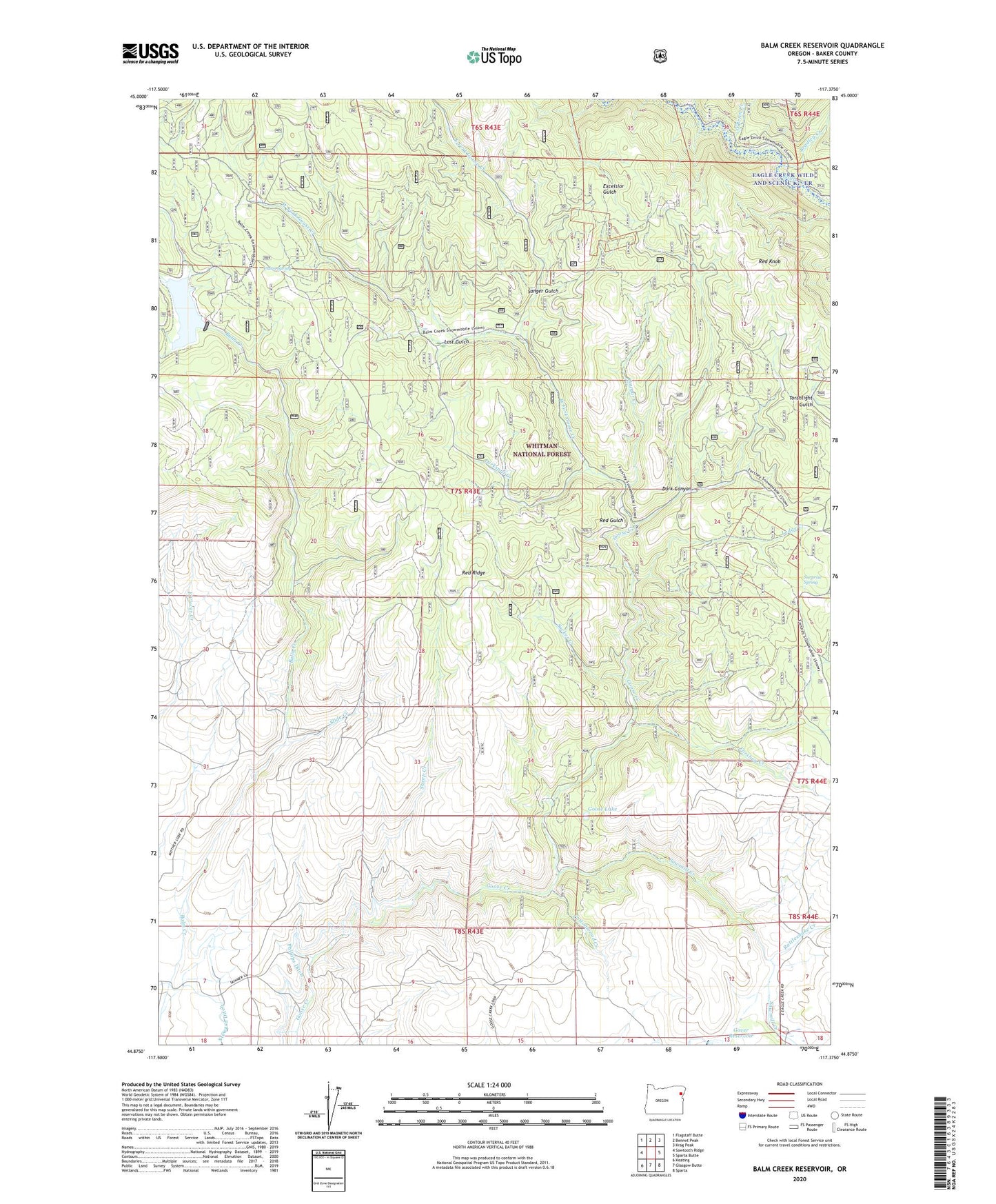
Balm Creek Reservoir Oregon US Topo Map
Couldn't load pickup availability
Also explore the Balm Creek Reservoir Forest Service Topo of this same quad for updated USFS data
2023 topographic map quadrangle Balm Creek Reservoir in the state of Oregon. Scale: 1:24000. Based on the newly updated USGS 7.5' US Topo map series, this map is in the following counties: Baker. The map contains contour data, water features, and other items you are used to seeing on USGS maps, but also has updated roads and other features. This is the next generation of topographic maps. Printed on high-quality waterproof paper with UV fade-resistant inks.
Quads adjacent to this one:
West: Sawtooth Ridge
Northwest: Flagstaff Butte
North: Bennet Peak
Northeast: Krag Peak
East: Sparta Butte
Southeast: Sparta
South: Glasgow Butte
Southwest: Keating
This map covers the same area as the classic USGS quad with code o44117h4.
Contains the following named places: Arthur Post Office, Balm Creek Dam, Balm Creek Reservoir, Balm Creek Reservoir Boat Launch, Balm Creek Reservoir Recreation Site, Balm Creek Shaft, Bennett Creek, Bradley Creek, Cottonwood Creek, Cougar Creek, Daddy Lode Mine, Dark Canyon, Eagle Creek Wild and Scenic River, East Fork Goose Creek, Forshey Creek, Forshey Meadow, Goose Lake, Goslin Corral, Larkspur Creek, Ledge Creek, Lily White Guard Station, Lost Gulch, O'Brien Creek, Phillips Ditch, Poorman Mine, Rattlesnake Creek, Red Gulch, Red Knob, Red Ridge, Sanger Gulch, Sanger Mine, Sanger Post Office, Saw Mill Gulch Dam, Sawmill Creek, Sheep Creek, Slide Creek, Sucker Creek, Surprise Spring, Surprise Springs Rural Fire and Rescue, Union Spring, West Fork Goose Creek