
MyTopo
Lehman Springs Oregon US Topo Map
Couldn't load pickup availability
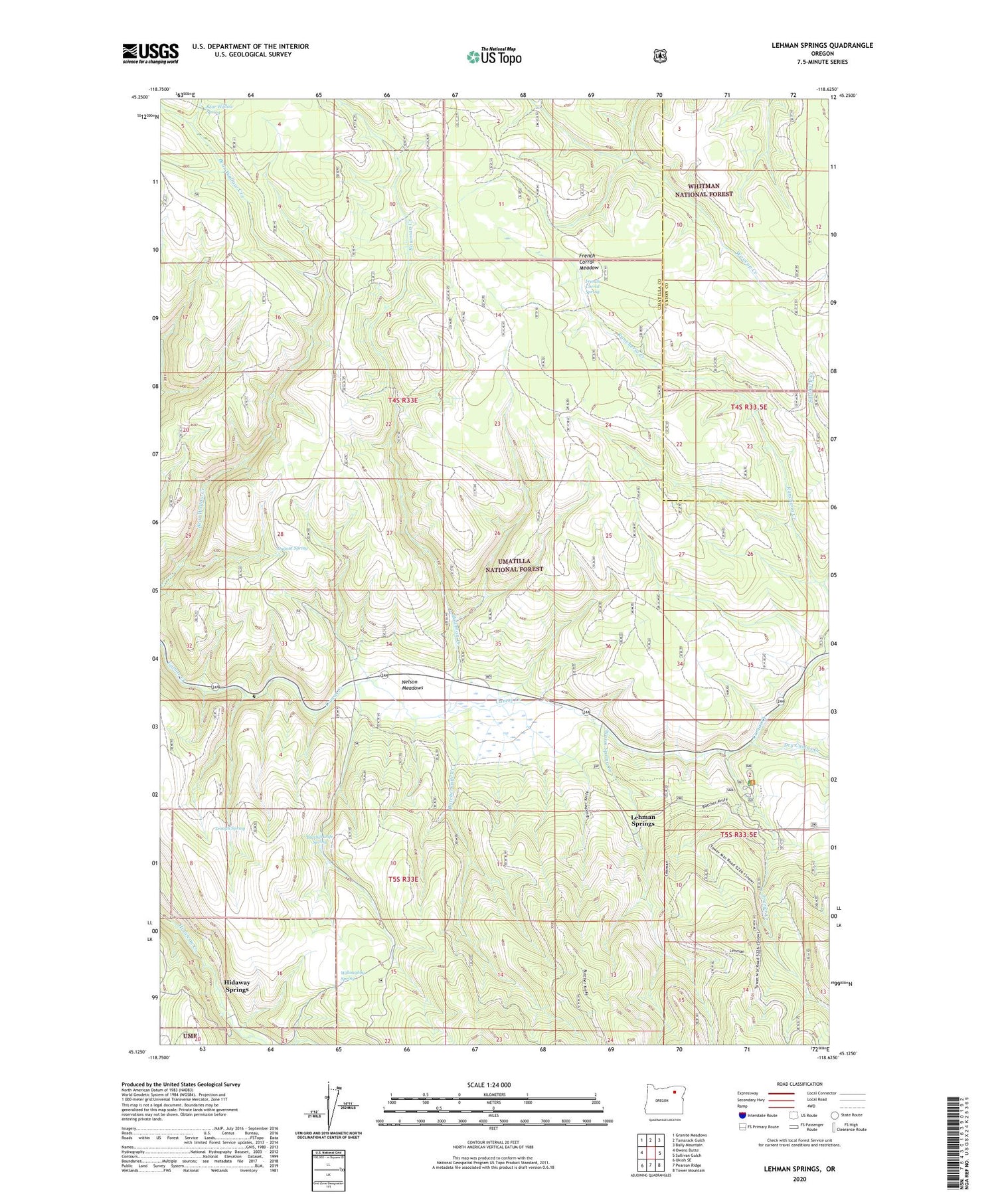
2020 topographic map quadrangle Lehman Springs in the state of Oregon. Scale: 1:24000. Based on the newly updated USGS 7.5' US Topo map series, this map is in the following counties: Umatilla, Union. The map contains contour data, water features, and other items you are used to seeing on USGS maps, but also has updated roads and other features. This is the next generation of topographic maps. Printed on high-quality waterproof paper with UV fade-resistant inks.
Quads adjacent to this one:
West: Owens Butte
Northwest: Granite Meadows
North: Tamarack Gulch
Northeast: Bally Mountain
East: Sullivan Gulch
Southeast: Tower Mountain
South: Pearson Ridge
Southwest: Ukiah SE
Contains the following named places: Bear Wallow Spring, Bowman Creek, Butcherknife Creek, Butcherknife Spring, Dry Camas Creek, Dugout Spring, Frazier Creek, Frazier Guard Station, Frazier Recreation Site, French Corral Meadow, French Corral Spring, Hidaway Springs, Lehman Hot Springs Post Office, Lehman Hot Springs Recreation Site, Lehman Springs, Nelson Meadows, Rancheria Creek, Salsbury Creek, Trough Spring, Warm Spring Creek, Willoughby Spring


