MyTopo
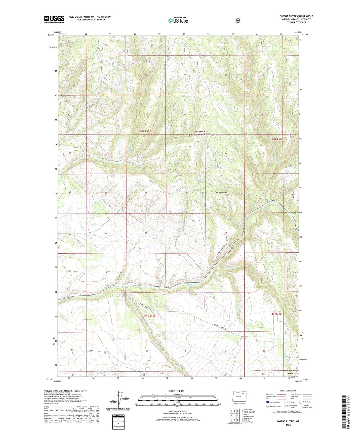
Owens Butte Oregon US Topo Map
Couldn't load pickup availability
Also explore the Owens Butte Forest Service Topo of this same quad for updated USFS data
2023 topographic map quadrangle Owens Butte in the state of Oregon. Scale: 1:24000. Based on the newly updated USGS 7.5' US Topo map series, this map is in the following counties: Umatilla. The map contains contour data, water features, and other items you are used to seeing on USGS maps, but also has updated roads and other features. This is the next generation of topographic maps. Printed on high-quality waterproof paper with UV fade-resistant inks.
Quads adjacent to this one:
West: Ukiah
Northwest: Carney Butte
North: Granite Meadows
Northeast: Tamarack Gulch
East: Lehman Springs
Southeast: Pearson Ridge
South: Ukiah SE
Southwest: Bridge Creek
This map covers the same area as the classic USGS quad with code o45118b7.
Contains the following named places: Bear Wallow Creek, Bear Wallow Creek Recreation Site, Cable Creek, Hidaway Creek, Lane Creek, Lane Creek Recreation Site, Lazinka School, Mud Creek, Owens Butte