MyTopo
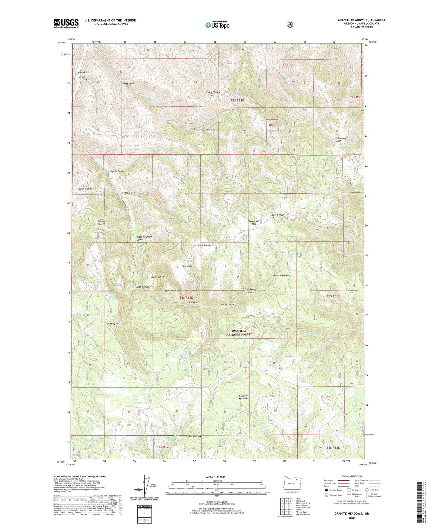
Granite Meadows Oregon US Topo Map
Couldn't load pickup availability
Also explore the Granite Meadows Forest Service Topo of this same quad for updated USFS data
2024 topographic map quadrangle Granite Meadows in the state of Oregon. Scale: 1:24000. Based on the newly updated USGS 7.5' US Topo map series, this map is in the following counties: Umatilla. The map contains contour data, water features, and other items you are used to seeing on USGS maps, but also has updated roads and other features. This is the next generation of topographic maps. Printed on high-quality waterproof paper with UV fade-resistant inks.
Quads adjacent to this one:
West: Carney Butte
Northwest: Nye
North: Pilot Rock
Northeast: Sevenmile Creek
East: Tamarack Gulch
Southeast: Lehman Springs
South: Owens Butte
Southwest: Ukiah
This map covers the same area as the classic USGS quad with code o45118c7.
Contains the following named places: Albee Meadow, Bear Wallow Camp Recreation Site, Bear Wallow Forest Service Station, Beeman Canyon, Blue Gulch, Bradley Flat, Bradley Flat Spring, Chute Gulch, Cold Spring, Cold Spring Canyon, Coyote Gulch, Fall Gulch, Granite Meadows, Hascall Spring, Kenny Gulch, Lower Bench, Merle Gulch, Pine Grove, Pine Grove Post Office, Rowley Cabin Spring, Sagebrush Flat, South Canyon, South Prairie, Table Mountain, Table Mountain Gulch, Upper Bench, Warner Family Cemetery, West Gulch