MyTopo
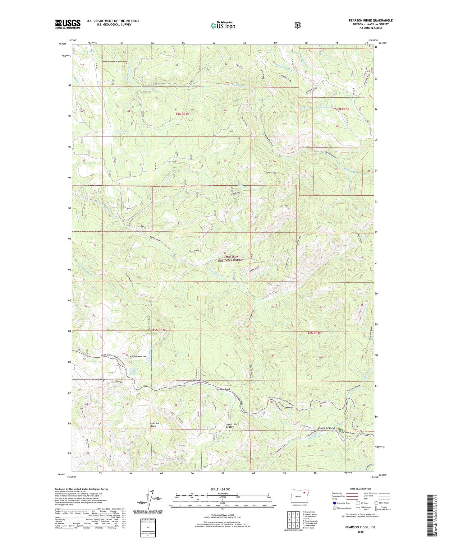
Pearson Ridge Oregon US Topo Map
Couldn't load pickup availability
Also explore the Pearson Ridge Forest Service Topo of this same quad for updated USFS data
2024 topographic map quadrangle Pearson Ridge in the state of Oregon. Scale: 1:24000. Based on the newly updated USGS 7.5' US Topo map series, this map is in the following counties: Umatilla. The map contains contour data, water features, and other items you are used to seeing on USGS maps, but also has updated roads and other features. This is the next generation of topographic maps. Printed on high-quality waterproof paper with UV fade-resistant inks.
Quads adjacent to this one:
West: Ukiah SE
Northwest: Owens Butte
North: Lehman Springs
Northeast: Sullivan Gulch
East: Tower Mountain
Southeast: Silver Butte
South: Kelsay Butte
Southwest: The Cockscomb
This map covers the same area as the classic USGS quad with code o45118a6.
Contains the following named places: Cable Creek Trail, Hunter Spring, Line Creek, Long Meadows, Neeves Creek, Oriental Basin, Pearson Guard Station, Pearson Recreation Site, Pearson Ridge, Pearson Trail, Round Meadow, Round Meadow Trail, Scott Spring, Upper Long Meadow, Weasel Spring, White Pine Trough Spring, Winom Creek Recreation Site, Winom Meadows