
MyTopo
Little Honey Creek Oregon US Topo Map
Couldn't load pickup availability
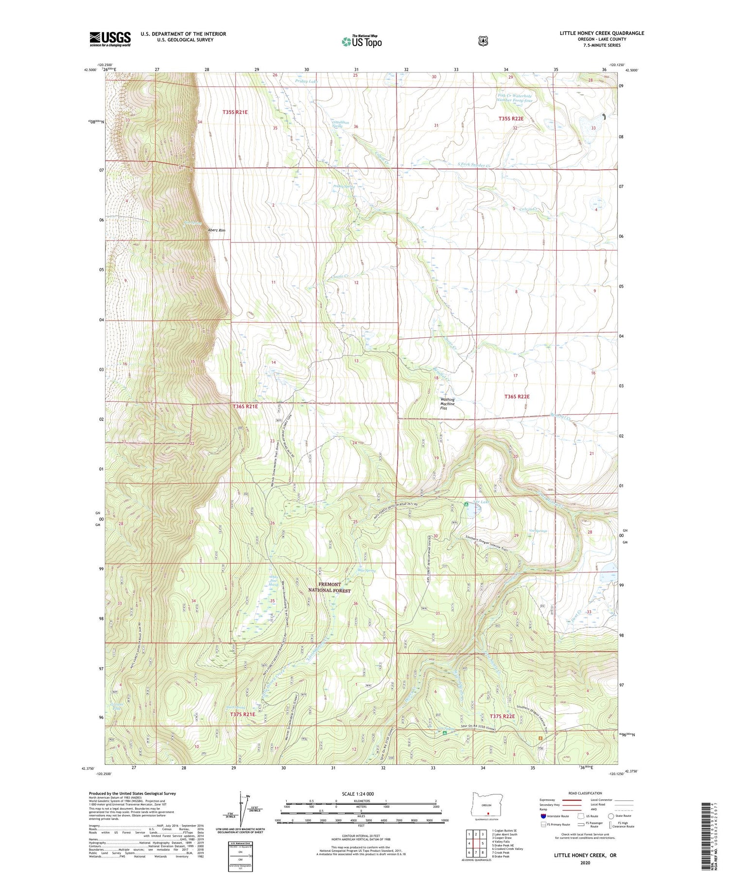
2020 topographic map quadrangle Little Honey Creek in the state of Oregon. Scale: 1:24000. Based on the newly updated USGS 7.5' US Topo map series, this map is in the following counties: Lake. The map contains contour data, water features, and other items you are used to seeing on USGS maps, but also has updated roads and other features. This is the next generation of topographic maps. Printed on high-quality waterproof paper with UV fade-resistant inks.
Quads adjacent to this one:
West: Valley Falls
Northwest: Coglan Buttes SE
North: Lake Abert South
Northeast: Cooper Draw
East: Drake Peak NE
Southeast: Drake Peak
South: Crook Peak
Southwest: Crooked Creek Valley
Contains the following named places: Abert Rim Viewpoint, Abert Spring, Blue Spring, Camp Warner, Can Spring, Can Spring Recreation Site, Chandler Cabin, First Swale Creek, Fish Creek Waterhole Number Forty-four, Fitzgerald Dam, Fitzgerald Reservoir, Grouse Flat, Little Honey Creek, O'Hallihan Spring, Pine Spring, Priday Lake, Priday Spring, Second Swale Creek, Swale Trailhead, Vee Lake, Vee Lake Boat Access, Vee Lake Trailhead, Vee Springs, Washing Machine Flat, White Pine Marsh


