MyTopo
Valley Falls Oregon US Topo Map
Couldn't load pickup availability
Also explore the Valley Falls Forest Service Topo of this same quad for updated USFS data
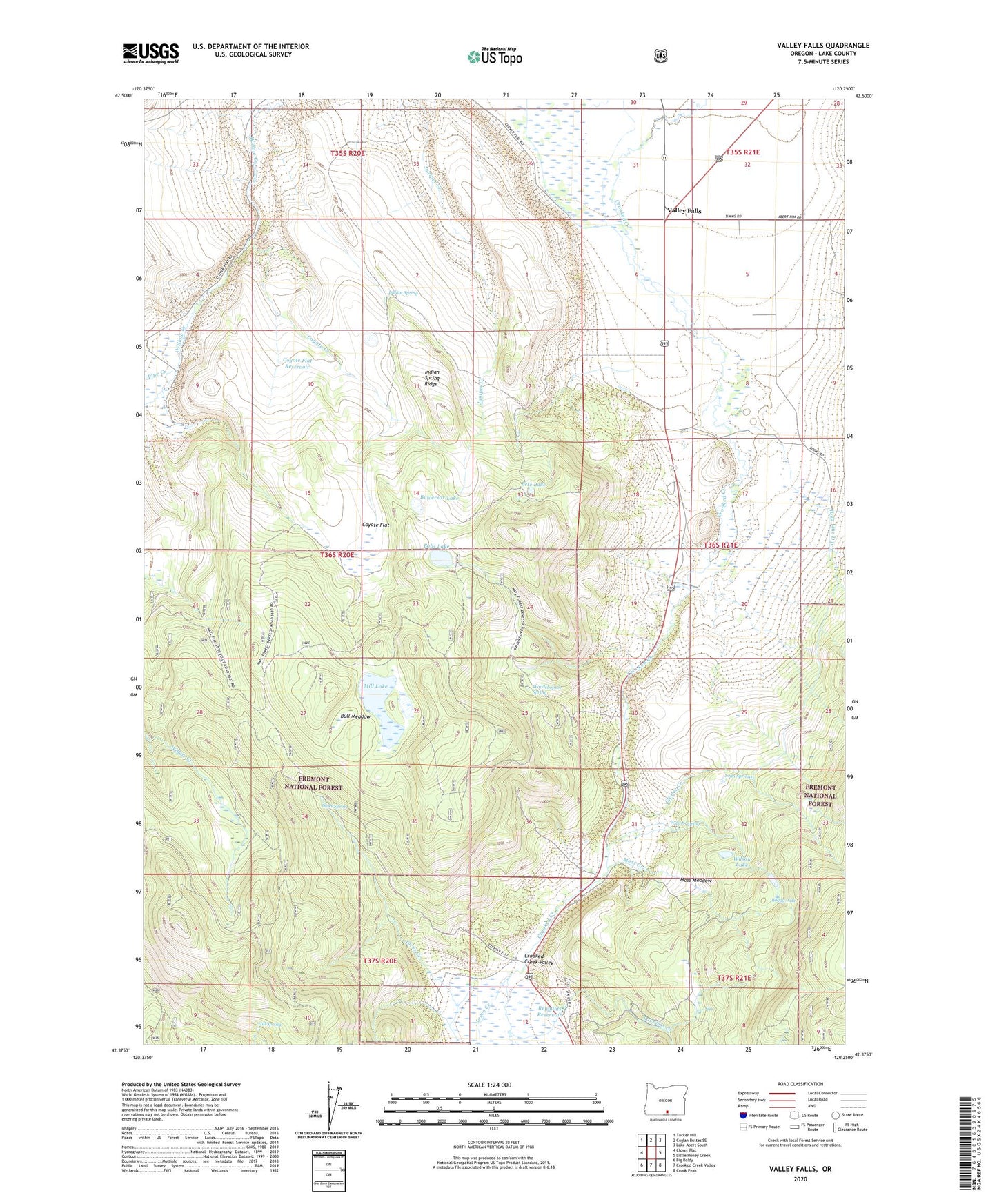
2024 topographic map quadrangle Valley Falls in the state of Oregon. Scale: 1:24000. Based on the newly updated USGS 7.5' US Topo map series, this map is in the following counties: Lake. The map contains contour data, water features, and other items you are used to seeing on USGS maps, but also has updated roads and other features. This is the next generation of topographic maps. Printed on high-quality waterproof paper with UV fade-resistant inks.
Quads adjacent to this one:
West: Clover Flat
Northwest: Tucker Hill
North: Coglan Buttes SE
Northeast: Lake Abert South
East: Little Honey Creek
Southeast: Crook Peak
South: Crooked Creek Valley
Southwest: Big Baldy
This map covers the same area as the classic USGS quad with code o42120d3.
Contains the following named places: Bobs Lake, Boggy Lake, Bowersox Lake, Bull Meadow, Campbell Mill, Chandler State Park, Clover Creek, Coyote Creek, Coyote Flat, Crooked Creek Valley, Dicks Creek, Dicks Ranch, Dicks Spring, High Line Ditch, Hill Spring, Indian Spring, Indian Spring Ridge, Loveless Creek, Loveless Homestead, Mill Lake, Moss Creek, Moss Meadow, O'Leary Ranch, Passage Ranch, Pete Lake, Pine Creek, Reynolds Reservoir, Schmidt Ranch, Simms Ranch, Soda Springs, Valley Falls, Valley Falls Post Office, Wilson Lake, Wilson Spring, Woodchopper Spring, Wright Ranch