MyTopo
Wickiup Spring Oregon US Topo Map
Couldn't load pickup availability
Also explore the Wickiup Spring Forest Service Topo of this same quad for updated USFS data
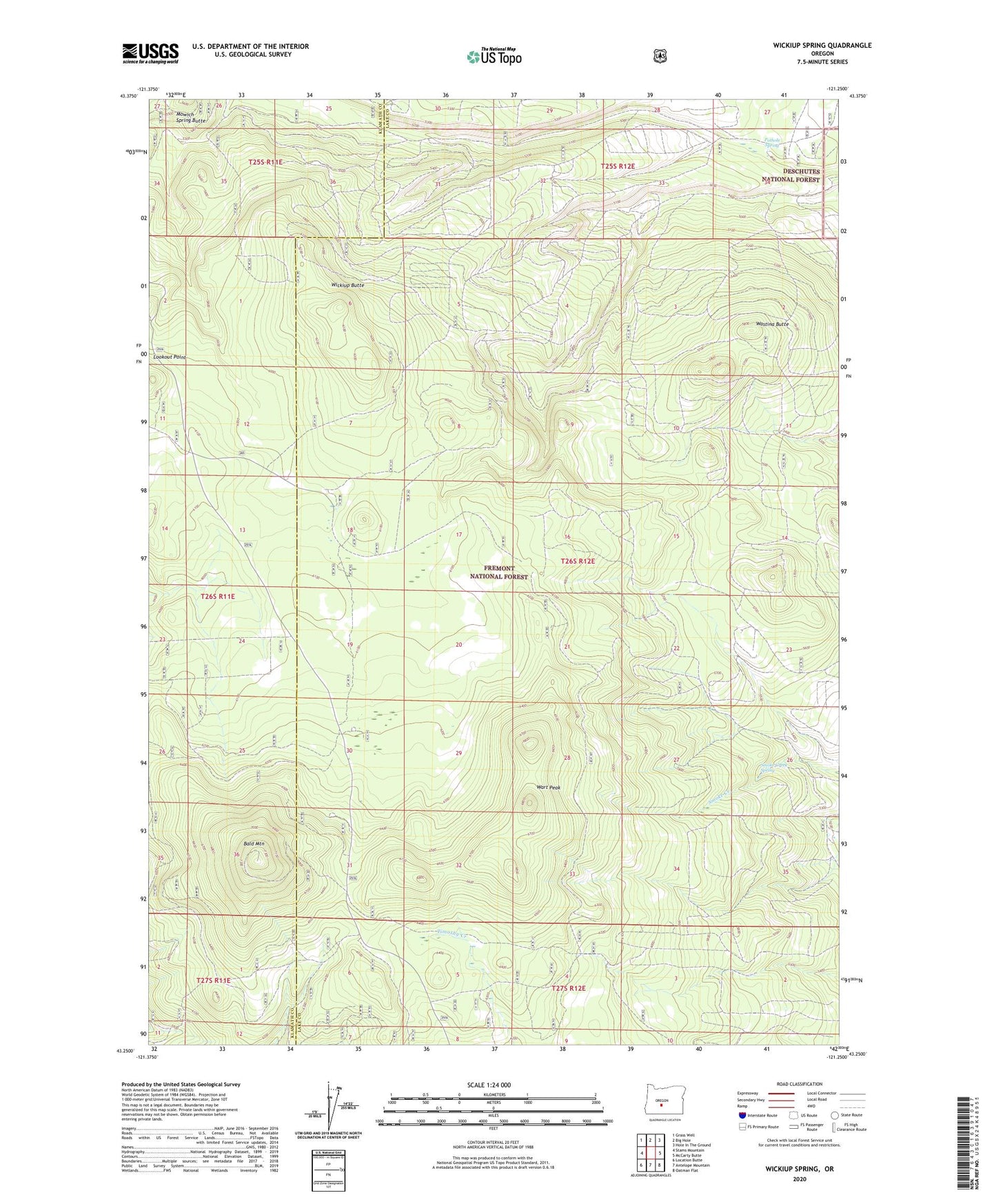
2023 topographic map quadrangle Wickiup Spring in the state of Oregon. Scale: 1:24000. Based on the newly updated USGS 7.5' US Topo map series, this map is in the following counties: Lake, Klamath. The map contains contour data, water features, and other items you are used to seeing on USGS maps, but also has updated roads and other features. This is the next generation of topographic maps. Printed on high-quality waterproof paper with UV fade-resistant inks.
Quads adjacent to this one:
West: Stams Mountain
Northwest: Grass Well
North: Big Hole
Northeast: Hole In The Ground
East: McCarty Butte
Southeast: Oatman Flat
South: Antelope Mountain
Southwest: Location Butte
This map covers the same area as the classic USGS quad with code o43121c3.
Contains the following named places: Bald Mountain, Bald Mountain Lookout, Community Reseeding Waterhole, Embody Post Office, Lookout Point, Pothole Spring, Smoke Creek Spring, Trapper Spring Recreation Site, Wart Peak, Wastina Butte, Wickiup Butte, Wickiup Spring Forest Service Station