MyTopo
Lost River Oregon US Topo Map
Couldn't load pickup availability
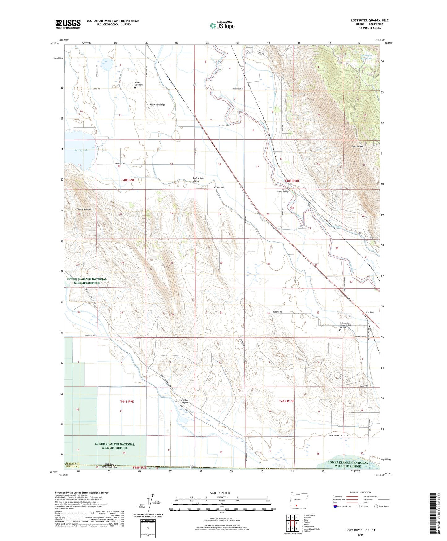
2023 topographic map quadrangle Lost River in the state of Oregon. Scale: 1:24000. Based on the newly updated USGS 7.5' US Topo map series, this map is in the following counties: Klamath, Siskiyou. The map contains contour data, water features, and other items you are used to seeing on USGS maps, but also has updated roads and other features. This is the next generation of topographic maps. Printed on high-quality waterproof paper with UV fade-resistant inks.
Quads adjacent to this one:
West: Worden
Northwest: Klamath Falls
North: Altamont
Northeast: Dairy
East: Merrill
Southeast: Hatfield
South: Lower Klamath Lake
Southwest: Sheepy Lake
This map covers the same area as the classic USGS quad with code o42121a6.
Contains the following named places: C Canal, Colson Post Office, Dehlinger, Dehlinger Reservoir, G Canal, Hill-Johnson Reservoir, Hosley, Independent Order of Odd Fellows Cemetery, Klamath Hills, KOTI-TV, Long Ranch Airport, Lost River, Lost River Post Office, Manning Ridge, Merrill Division, Mount Laki Cemetery, Spring Lake, Stukel, Stukel Bridge, Stukel Mountain, White Lake City, Whitelake Post Office