MyTopo
Mahogany Butte Oregon US Topo Map
Couldn't load pickup availability
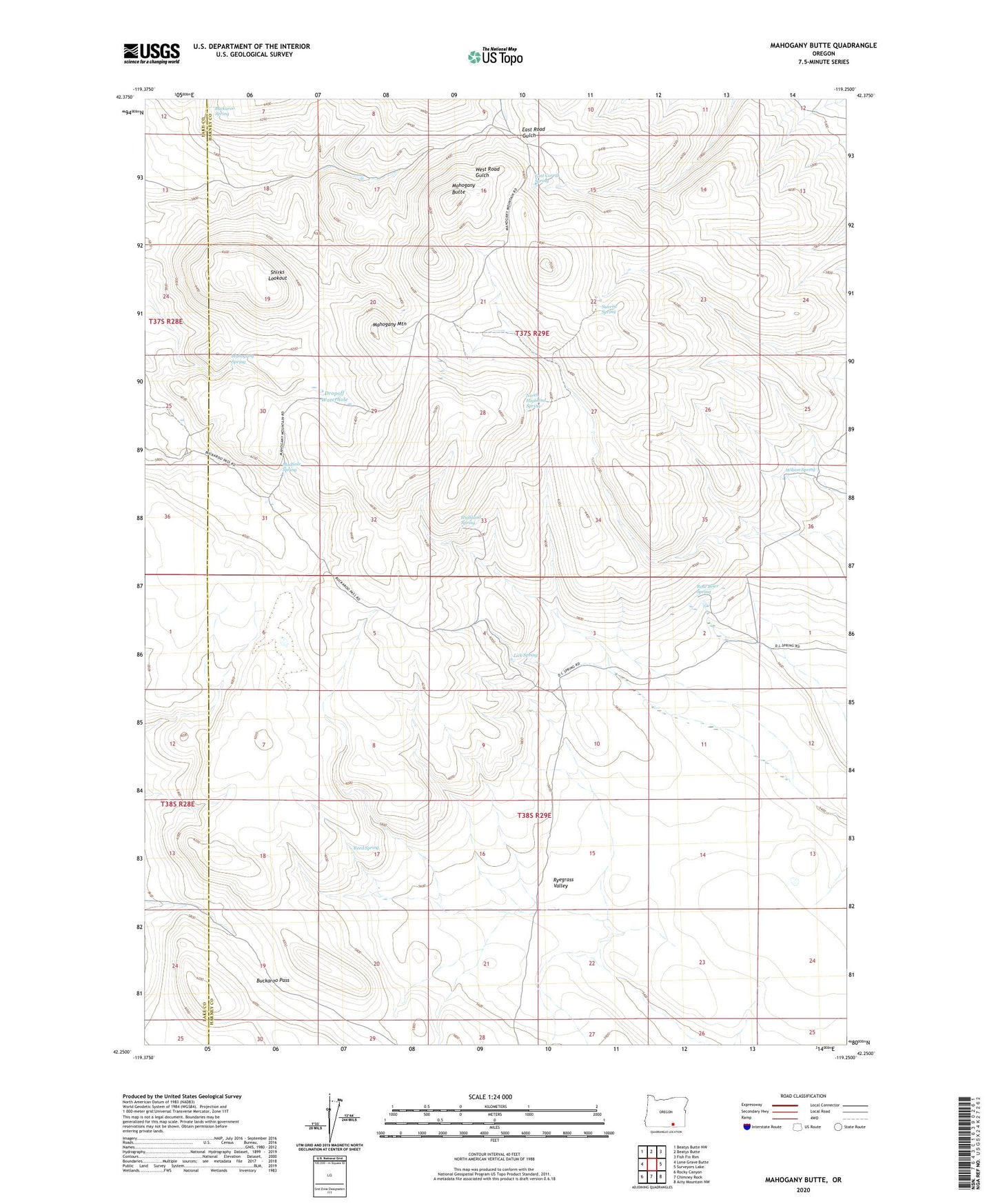
2023 topographic map quadrangle Mahogany Butte in the state of Oregon. Scale: 1:24000. Based on the newly updated USGS 7.5' US Topo map series, this map is in the following counties: Harney, Lake. The map contains contour data, water features, and other items you are used to seeing on USGS maps, but also has updated roads and other features. This is the next generation of topographic maps. Printed on high-quality waterproof paper with UV fade-resistant inks.
Quads adjacent to this one:
West: Lone Grave Butte
Northwest: Beatys Butte NW
North: Beatys Butte
Northeast: Fish Fin Rim
East: Surveyors Lake
Southeast: Acty Mountain NW
South: Chimney Rock
Southwest: Rocky Canyon
This map covers the same area as the classic USGS quad with code o42119c3.
Contains the following named places: Buckaroo Pass, Buckaroo Spring, Dropoff Waterhole, East Corral Spring, Highland Spring, Lick Spring, Mahogany Butte, Mahogany Mountain, Mahogany Spring, Mudhole Spring, North Highland Spring, Reed Spring, Rock Springs Camp, Rose Brier Spring, Ryegrass Valley, Shirks Lookout, Sunrise Spring, Wilson Spring