MyTopo
Beatys Butte NW Oregon US Topo Map
Couldn't load pickup availability
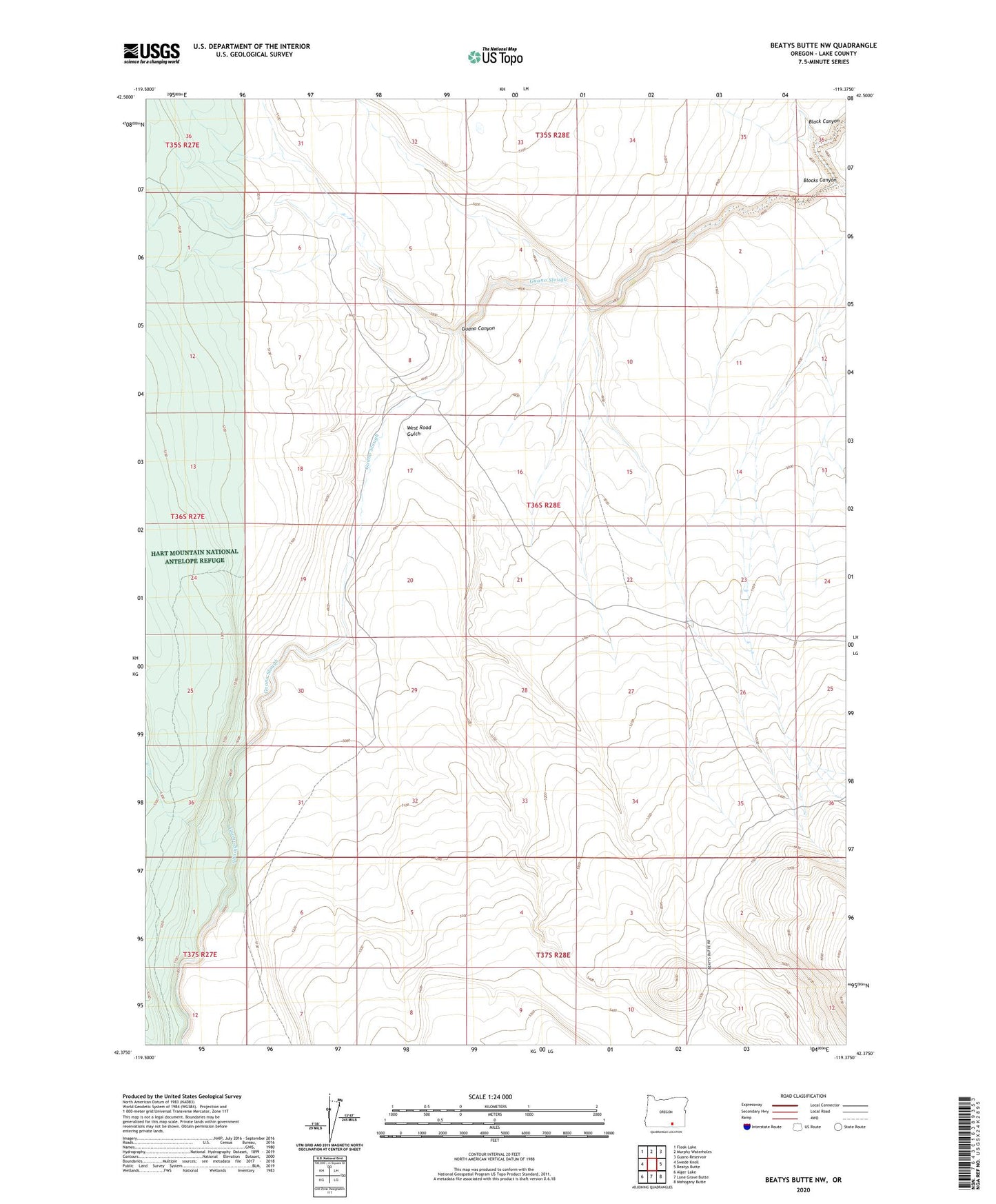
2023 topographic map quadrangle Beatys Butte NW in the state of Oregon. Scale: 1:24000. Based on the newly updated USGS 7.5' US Topo map series, this map is in the following counties: Lake. The map contains contour data, water features, and other items you are used to seeing on USGS maps, but also has updated roads and other features. This is the next generation of topographic maps. Printed on high-quality waterproof paper with UV fade-resistant inks.
Quads adjacent to this one:
West: Swede Knoll
Northwest: Flook Lake
North: Murphy Waterholes
Northeast: Guano Reservoir
East: Beatys Butte
Southeast: Mahogany Butte
South: Lone Grave Butte
Southwest: Alger Lake
This map covers the same area as the classic USGS quad with code o42119d4.
Contains the following named places: Blocks Canyon, Guano Canyon, Ornoname 3 Dam, West Road Gulch