MyTopo
Marys Peak Oregon US Topo Map
Couldn't load pickup availability
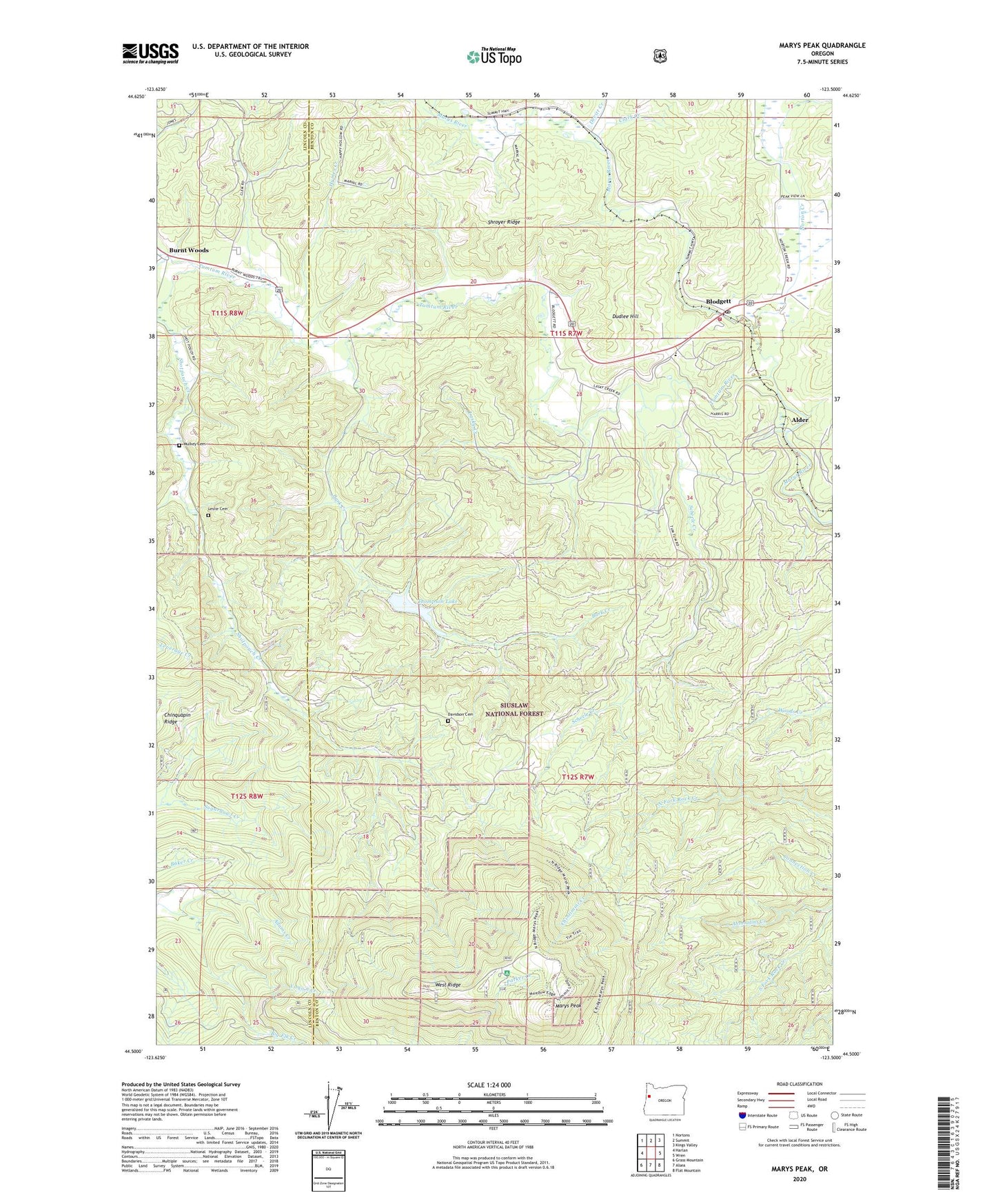
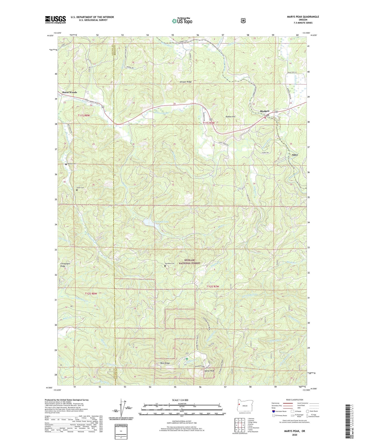
2020 topographic map quadrangle Marys Peak in the state of Oregon. Scale: 1:24000. Based on the newly updated USGS 7.5' US Topo map series, this map is in the following counties: Benton, Lincoln. The map contains contour data, water features, and other items you are used to seeing on USGS maps, but also has updated roads and other features. This is the next generation of topographic maps. Printed on high-quality waterproof paper with UV fade-resistant inks.
Quads adjacent to this one:
West: Harlan
Northwest: Nortons
North: Summit
Northeast: Kings Valley
East: Wren
Southeast: Flat Mountain
South: Alsea
Southwest: Grass Mountain
Contains the following named places: Alder, Bark Creek, Blodgett, Blodgett - Summit Rural Fire Protection District Station 1, Blodgett Census Designated Place, Blodgett Elementary School, Blodgett Post Office, Burnt Woods, Burnt Woods Post Office, Burnt Woods State Forest Service Station, Butler, Cain, Chintimini Creek, Clark Creek, Conger, Corvallis Watershed Wild Animal Refuge, Davidson Cemetery, Devitt, Devitt Creek, Devitt Post Office, Dudlee Hill, Hymes Creek, Knights of Pythias Camp, Lasky Creek, Leslie Cemetery, Marval, Marys Peak, Marys Peak Botanical Special Interest Area, Marys Peak Observation Point, Marys Peak Recreation Site, Meadow Sno-Park, Noble Fir Management Buffer Zone, North Ridge Sno-Park, Norton Creek, Peak, Peak Post Office, Scheele Creek, Shotpouch Cemetery, Shotpouch Creek, Shroyer Ridge, Thompson Dam, Thompson Lake, Tumtum River, Wesley Post Office, West Ridge, Westpoint Sno-Park, Wilson Cemetery, Yaqo'n Creek, ZIP Code: 97326