MyTopo
Maupin Butte Oregon US Topo Map
Couldn't load pickup availability
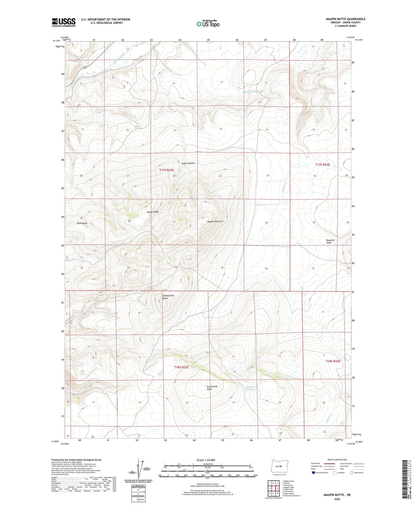
2023 topographic map quadrangle Maupin Butte in the state of Oregon. Scale: 1:24000. Based on the newly updated USGS 7.5' US Topo map series, this map is in the following counties: Crook. The map contains contour data, water features, and other items you are used to seeing on USGS maps, but also has updated roads and other features. This is the next generation of topographic maps. Printed on high-quality waterproof paper with UV fade-resistant inks.
Quads adjacent to this one:
West: Liggett Table
Northwest: Rabbit Valley
North: Paulina
Northeast: Mud Spring
East: Angell Butte
Southeast: Twelvemile Reservoir
South: Hardin Ranch
Southwest: Sand Hollow
This map covers the same area as the classic USGS quad with code o44119a8.
Contains the following named places: Homestead Butte, Maupin Butte, Maupin Spring, Milk Butte, Odell Hollow, Paulina Rodeo Grounds, Payne Ridge, Ryegrass Ranch, Summit Reservoir, Twelvemile Table