MyTopo
McCullough Creek Oregon US Topo Map
Couldn't load pickup availability
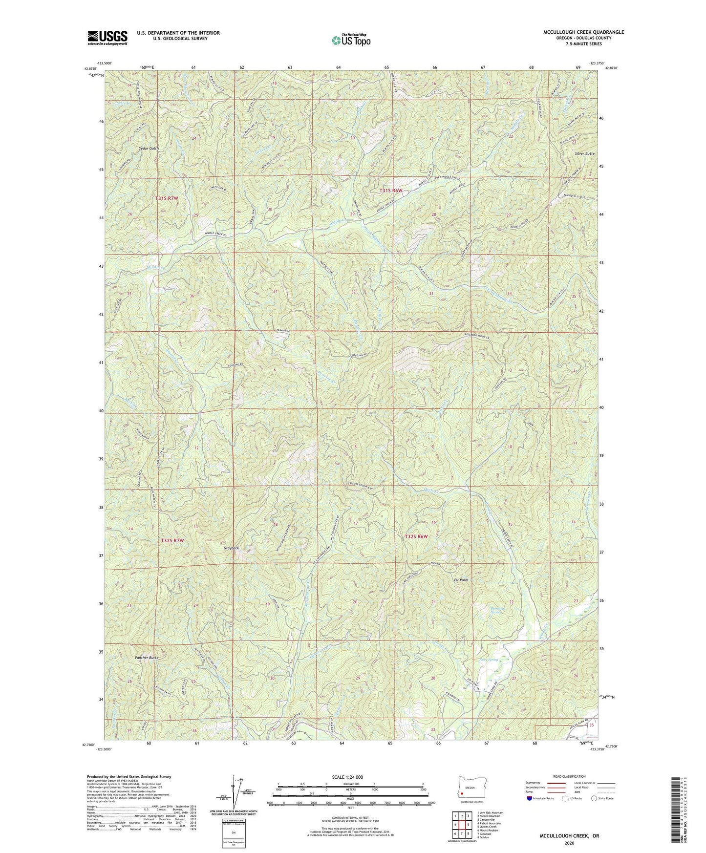
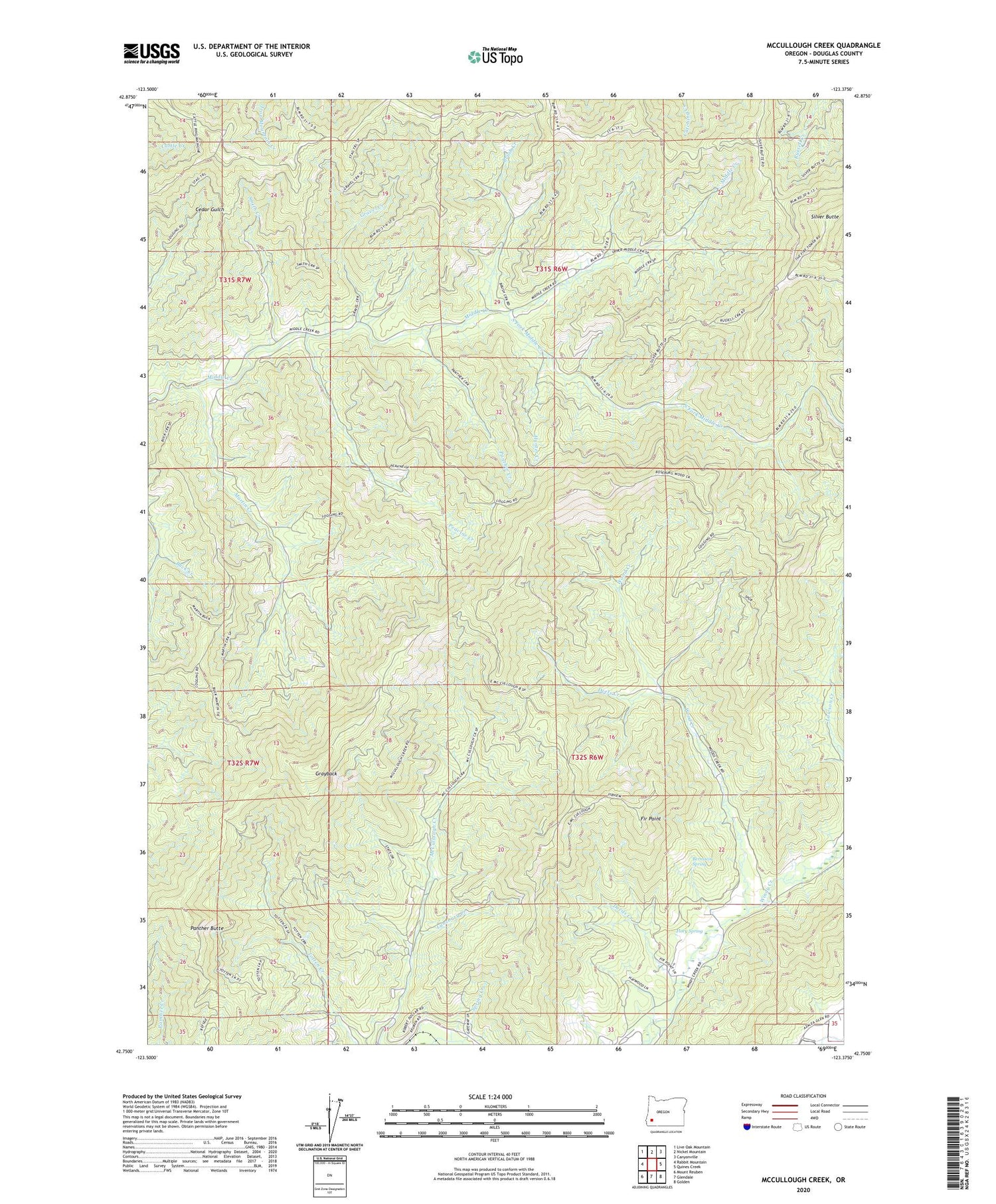
2020 topographic map quadrangle McCullough Creek in the state of Oregon. Scale: 1:24000. Based on the newly updated USGS 7.5' US Topo map series, this map is in the following counties: Douglas. The map contains contour data, water features, and other items you are used to seeing on USGS maps, but also has updated roads and other features. This is the next generation of topographic maps. Printed on high-quality waterproof paper with UV fade-resistant inks.
Quads adjacent to this one:
West: Rabbit Mountain
Northwest: Live Oak Mountain
North: Nickel Mountain
Northeast: Canyonville
East: Quines Creek
Southeast: Golden
South: Glendale
Southwest: Mount Reuben
Contains the following named places: Bernstein Spring, Brush Creek, Cedar Camp, Cow Creek Game Refuge, Deeds Creek, Deets Creek, Fir Point, Fir Point Christian Camp, Flory Spring, Gravel Creek, Grayback, Grayback Trail, Hayward Pond, Hunter Creek, Lawson Creek, Lunsbury Creek, Martin Creek, Panther Butte, Panther Creek, Peavine Creek, Silver Butte, Smith Creek, South Fork Camp, South Fork Middle Creek, South Fork Trail, Spring Creek, Stag Trail, Wood Creek, ZIP Code: 97442