
MyTopo
McKinley Oregon US Topo Map
Couldn't load pickup availability
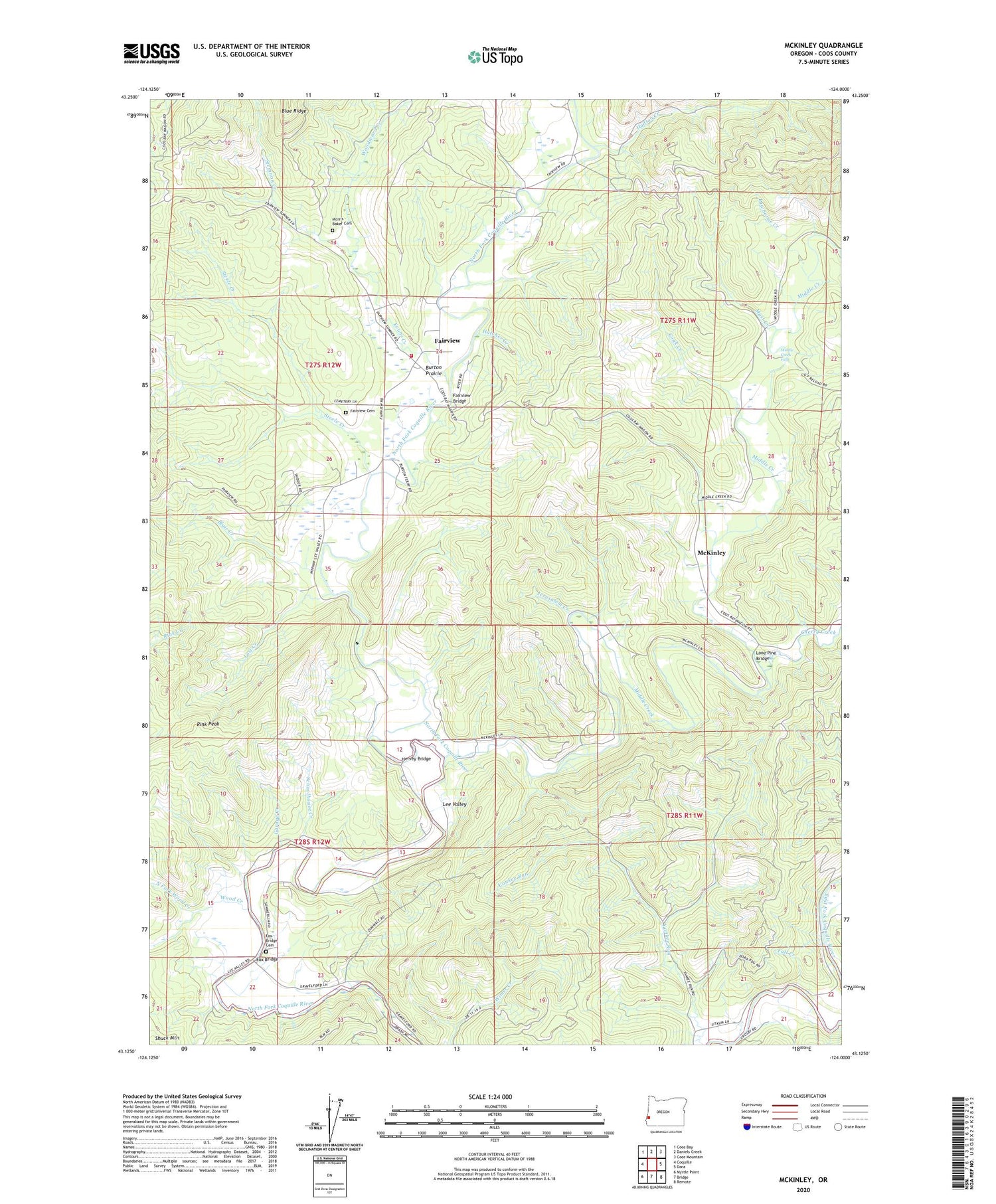
2020 topographic map quadrangle McKinley in the state of Oregon. Scale: 1:24000. Based on the newly updated USGS 7.5' US Topo map series, this map is in the following counties: Coos. The map contains contour data, water features, and other items you are used to seeing on USGS maps, but also has updated roads and other features. This is the next generation of topographic maps. Printed on high-quality waterproof paper with UV fade-resistant inks.
Quads adjacent to this one:
West: Coquille
Northwest: Coos Bay
North: Daniels Creek
Northeast: Coos Mountain
East: Dora
Southeast: Remote
South: Bridge
Southwest: Myrtle Point
Contains the following named places: Blair Creek, Burton Prairie, Camp Tawanka, Cherry Creek, Coak Creek, Coos County, Coos County Youth Camp, Evans Creek, Fairview, Fairview Bridge, Fairview Cemetery, Fairview Post Office, Fairview Rural Fire Protection District, Fall Creek, Fox Bridge, Fox Bridge Cemetery, Garage Creek, Hatcher Creek, Hervey Bridge, Hervey Quarry, Hudson Creek, Jerusalem Creek, Lawhorne Creek, Lee, Lee Post Office, Lee Valley, Lone Pine Bridge, Lost Creek, Luda Post Office, Mast Creek, McKinley, McKinley Post Office, Middle Creek, Middle Creek County Park, Middle Creek Falls, Morris - Baker Cemetery, North Fork Wood Creek, Pleasant Hill School, Rink Peak, Rock Prairie County Park, Schoolhouse Creek, Sidney Post Office, Steele Creek, Steinnon Creek, Swayne Creek, Wood Creek, Woodward Creek


