MyTopo
Remote Oregon US Topo Map
Couldn't load pickup availability
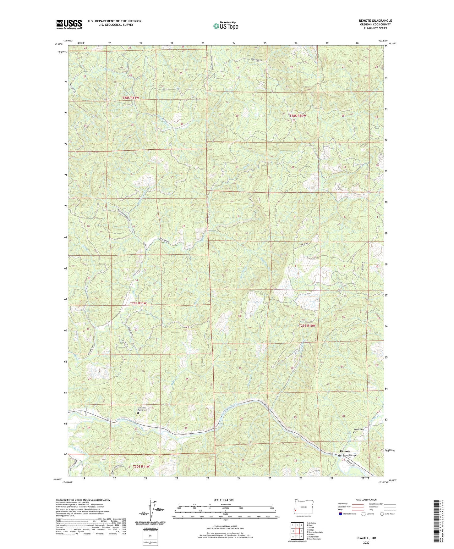
2023 topographic map quadrangle Remote in the state of Oregon. Scale: 1:24000. Based on the newly updated USGS 7.5' US Topo map series, this map is in the following counties: Coos. The map contains contour data, water features, and other items you are used to seeing on USGS maps, but also has updated roads and other features. This is the next generation of topographic maps. Printed on high-quality waterproof paper with UV fade-resistant inks.
Quads adjacent to this one:
West: Bridge
Northwest: McKinley
North: Dora
Northeast: Sitkum
East: Kenyon Mountain
Southeast: Bone Mountain
South: Rasler Creek
Southwest: Powers
This map covers the same area as the classic USGS quad with code o43123a8.
Contains the following named places: Axe Creek, Bear Pan Creek, Bear Pen Creek, Belieu Creek, Brownson Creek, Coquille Reservation, Enchanted Prairie, Enchanted Prairie Cemetery, Fall Creek, Fetter Cemetery, Fetter Creek, Frenchie Creek, Myrtle Creek, Myrtle Point Division, Remote, Remote Bridge, Remote Post Office, Sandy Creek, Sandy Creek Covered Bridge, Slide Creek, South Fork Elk Creek, Tanner Creek