MyTopo
McLeod Oregon US Topo Map
Couldn't load pickup availability
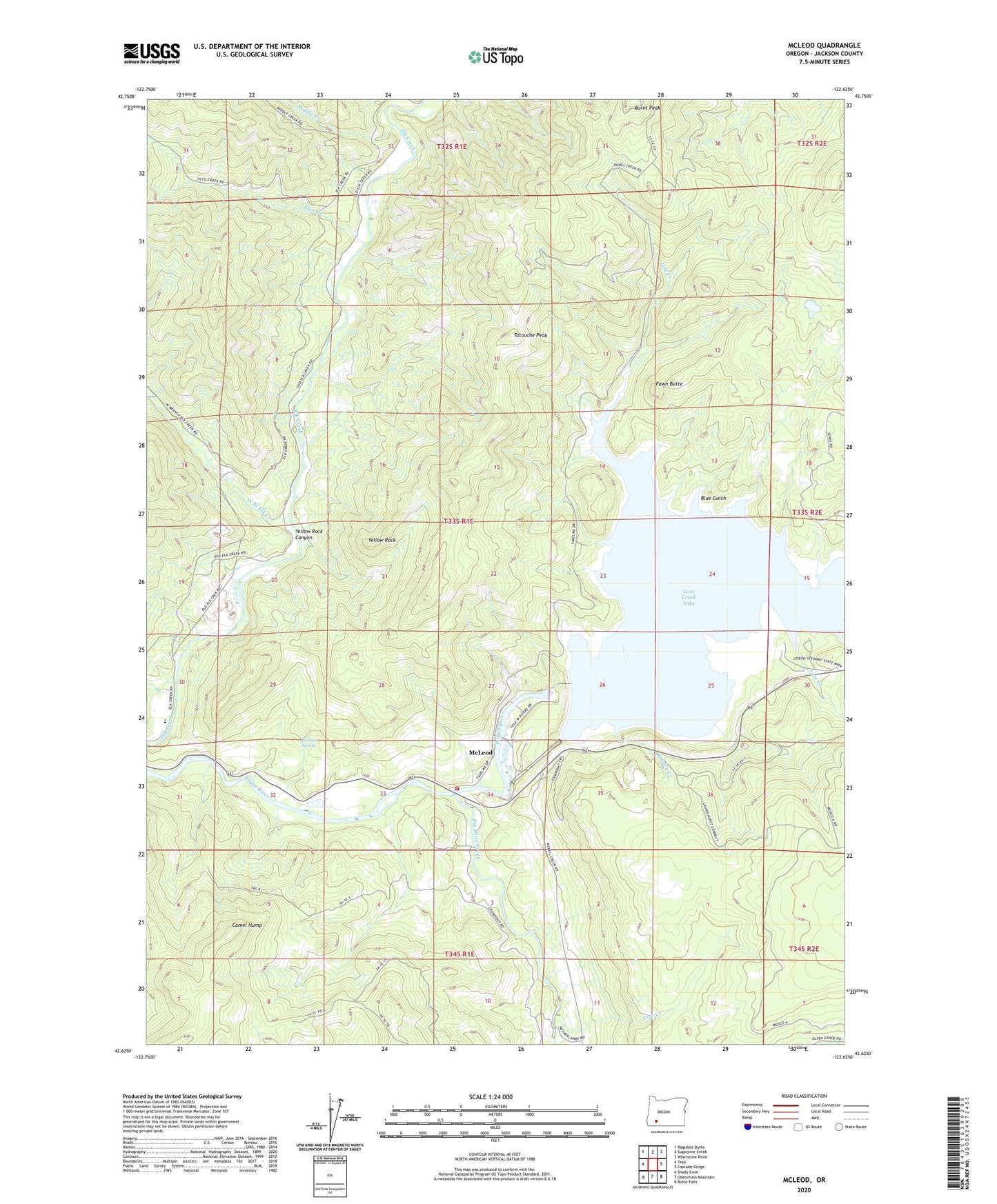
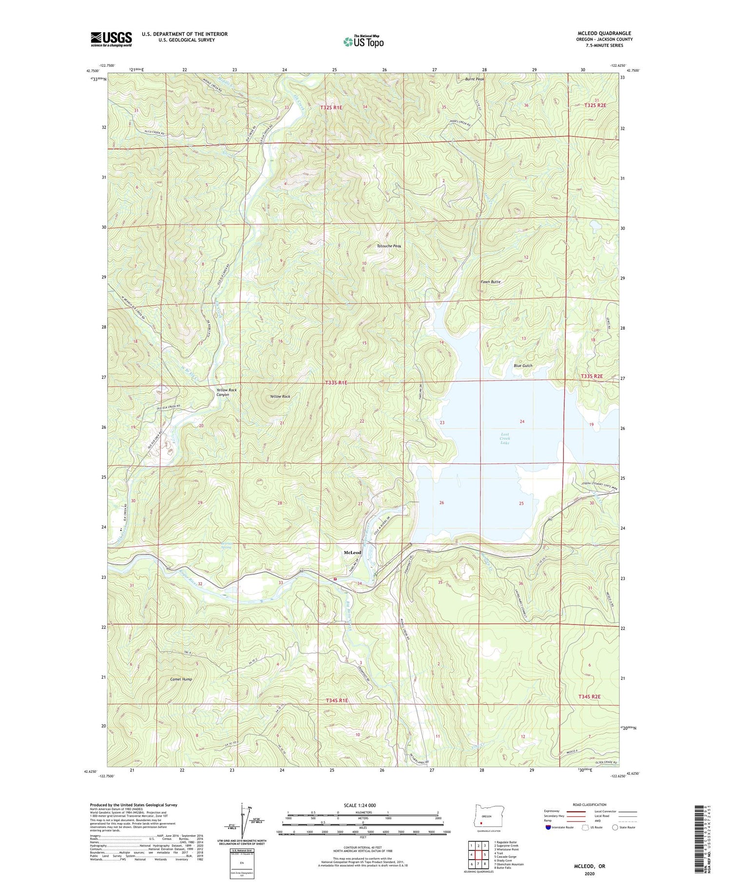
2020 topographic map quadrangle McLeod in the state of Oregon. Scale: 1:24000. Based on the newly updated USGS 7.5' US Topo map series, this map is in the following counties: Jackson. The map contains contour data, water features, and other items you are used to seeing on USGS maps, but also has updated roads and other features. This is the next generation of topographic maps. Printed on high-quality waterproof paper with UV fade-resistant inks.
Quads adjacent to this one:
West: Trail
Northwest: Ragsdale Butte
North: Sugarpine Creek
Northeast: Whetstone Point
East: Cascade Gorge
Southeast: Butte Falls
South: Obenchain Mountain
Southwest: Shady Cove
Contains the following named places: Alco Creek, Alcoe Post Office, Berrian Spring, Berry Creek, Big Butte Creek, Blue Gulch, Burnt Peak, Camel Hump, Casey State Park, Casey State Recreation Site Non-Motorized Boat Ramp, Cole M Rivers Fish Hatchery, Elk Creek Dam, Elk Creek Lake, Elk Creek Reservoir, Elk Trail Elementary School, Fall Creek, Fawn Butte, Floras Creek, Jackson County Fire District 4 Trail Station, Joseph Stewart State Park Boat Ramp, Lost Creek, Lost Creek Dam, Lost Creek Lake, McGregor Park, McGregor Park Non-Motor Boat Ramp, McLeod, McLeod Forest Service Station, McLeod Guard Station, McLeod Wayside, Middle Creek, Peyton Post Office, Rivers Edge Park, Rogue River Non - Motorized Boat Launch, Rumley Creek, Sandoz, Spot Creek, Stewart State Park Lost Creek Lake Marina, Takelma Boat Ramp, Takelma Park Picnic Area, Tatouche Peak, Vine Creek, West Branch Elk Creek, Yellow Rock, Yellow Rock Canyon