MyTopo
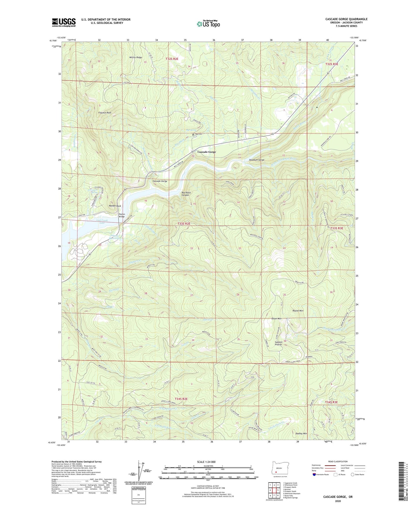
Cascade Gorge Oregon US Topo Map
Couldn't load pickup availability
Also explore the Cascade Gorge Forest Service Topo of this same quad for updated USFS data
2024 topographic map quadrangle Cascade Gorge in the state of Oregon. Scale: 1:24000. Based on the newly updated USGS 7.5' US Topo map series, this map is in the following counties: Jackson. The map contains contour data, water features, and other items you are used to seeing on USGS maps, but also has updated roads and other features. This is the next generation of topographic maps. Printed on high-quality waterproof paper with UV fade-resistant inks.
Quads adjacent to this one:
West: McLeod
Northwest: Sugarpine Creek
North: Whetstone Point
Northeast: Prospect North
East: Prospect South
Southeast: Big Butte Springs
South: Butte Falls
Southwest: Obenchain Mountain
This map covers the same area as the classic USGS quad with code o42122f5.
Contains the following named places: Cascade Gorge, Cold Spring Creek, Diamond Creek, Dudley, Dudley Mountain, Dudley Post Office, Evergreen Spring, Flounce Rock, Hole in the Ground Creek, Hurd Creek, Joseph H Stewart State Park, Katydid Ranch, Knighten Creek, Leeds Post Office, Middle Creek, Needle Rock, North Fork Clark Creek, Nye Cemetery, Nye Ditch, Nye Spring, Olson Mountain, Payton, Peyton Bridge, Peyton Reservoir, Prospect Guard Station, Prospect Power Plant, Red Rock Canyon, Round Mountain, Skookum Creek, Skookum Gorge, Smith Creek, South Fork Clark Creek, South Fork Rogue River, Summit Prairie, Taggarts Creek, Tie Creek, Whelpley Post Office