MyTopo
Ragsdale Butte Oregon US Topo Map
Couldn't load pickup availability
Also explore the Ragsdale Butte Forest Service Topo of this same quad for updated USFS data
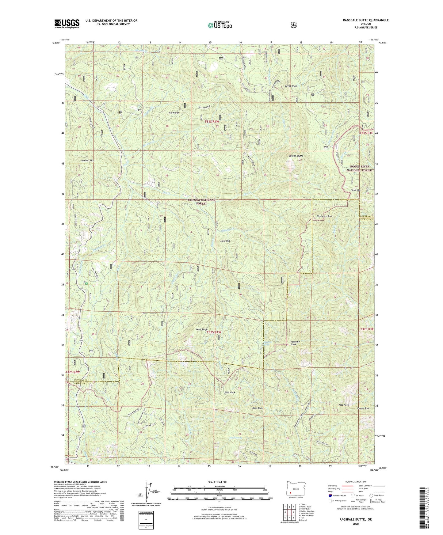
2023 topographic map quadrangle Ragsdale Butte in the state of Oregon. Scale: 1:24000. Based on the newly updated USGS 7.5' US Topo map series, this map is in the following counties: Douglas, Jackson. The map contains contour data, water features, and other items you are used to seeing on USGS maps, but also has updated roads and other features. This is the next generation of topographic maps. Printed on high-quality waterproof paper with UV fade-resistant inks.
Quads adjacent to this one:
West: Richter Mountain
Northwest: Tiller
North: Pickett Butte
Northeast: Butler Butte
East: Sugarpine Creek
Southeast: McLeod
South: Trail
Southwest: Cleveland Ridge
This map covers the same area as the classic USGS quad with code o42122g7.
Contains the following named places: Alco Rock, Alco Trail, Blue Rock, Cowbell Mountain, Dead Horse Creek, Devils Knob, Devils Knob Camp, Devils Knob Lookout, Diamond Creek, Divide Guard Station, East Fork Elk Creek, Flat Creek, Flats Ranch, Growey Creek, Hawk Mountain, Jacques Creek, Middle Ridge, Mitchell Creek, Mule Hill, Old Johnson Mill, Oliver Spring, Pilot Rock, Ragsdale Butte, Ragsdale Lookout, Ragsdale Spring, Rattlesnake Trail, Rogue-Umpqua Divide Trail, Savage Bluffs, Section Creek, Shangri-La Mill, Shed Camp, Shed Creek, Summit Cabin, Threehorn Recreation Site, Timber Cabin, Timbered Rock, Tison School, Tison Trail, Warren Tison Ranch, Wolf Prairie, Wolf Ridge, ZIP Code: 97541