MyTopo
Obenchain Mountain Oregon US Topo Map
Couldn't load pickup availability
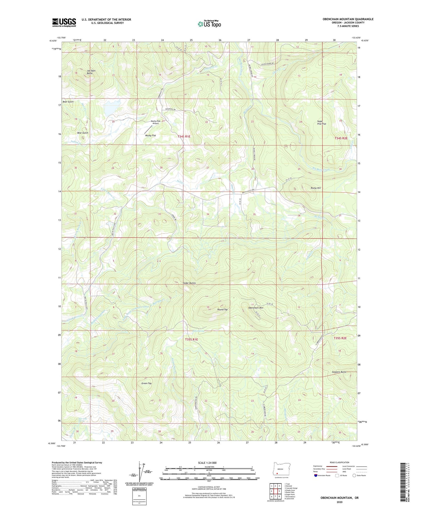
2023 topographic map quadrangle Obenchain Mountain in the state of Oregon. Scale: 1:24000. Based on the newly updated USGS 7.5' US Topo map series, this map is in the following counties: Jackson. The map contains contour data, water features, and other items you are used to seeing on USGS maps, but also has updated roads and other features. This is the next generation of topographic maps. Printed on high-quality waterproof paper with UV fade-resistant inks.
Quads adjacent to this one:
West: Shady Cove
Northwest: Trail
North: McLeod
Northeast: Cascade Gorge
East: Butte Falls
South: Brownsboro
Southwest: Eagle Point
This map covers the same area as the classic USGS quad with code o42122e6.
Contains the following named places: Bear Gulch, Bull Run Creek, Cattail Creek, Cedar Buttes, Clark Creek, Crowfoot Creek, Daley Spring, Deer Creek, Deer Lick Spring, Derby, Derby Post Office, Derby School, Derby Station, Duprays Mill, Eagle Point Irrigation Canal, Edsalla, Geppert Butte, Gray Creek, Green Top, Indian Lake Reservoir, Joe Dyer Butte, McNeil Creek, Mucky Flat, Mucky Flat Airport, Neil Creek, Obenchain Mountain, Quartz Creek, Rocky Hill, Round Top, Sugar Pine Flat