MyTopo
Huckleberry Mountain Oregon US Topo Map
Couldn't load pickup availability
Also explore the Huckleberry Mountain Forest Service Topo of this same quad for updated USFS data
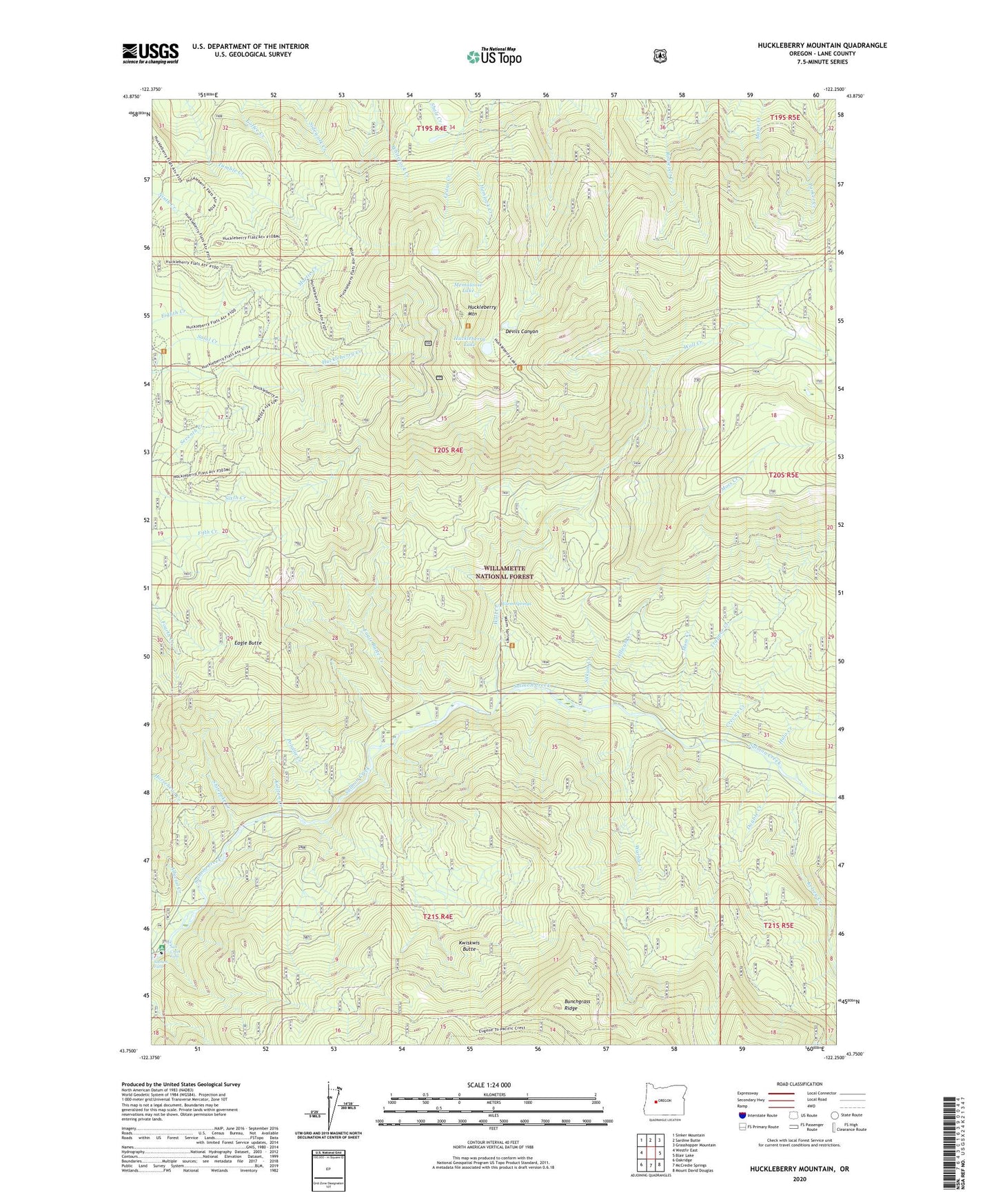
2024 topographic map quadrangle Huckleberry Mountain in the state of Oregon. Scale: 1:24000. Based on the newly updated USGS 7.5' US Topo map series, this map is in the following counties: Lane. The map contains contour data, water features, and other items you are used to seeing on USGS maps, but also has updated roads and other features. This is the next generation of topographic maps. Printed on high-quality waterproof paper with UV fade-resistant inks.
Quads adjacent to this one:
West: Westfir East
Northwest: Sinker Mountain
North: Sardine Butte
Northeast: Grasshopper Mountain
East: Blair Lake
Southeast: Mount David Douglas
South: McCredie Springs
Southwest: Oakridge
This map covers the same area as the classic USGS quad with code o43122g3.
Contains the following named places: Alluvial Creek, Black Creek, Crevice Creek, Dead Mountain Trail, Double Creek, Eagle Butte, Eagle Butte Creek, Halo Creek, Hemlock Creek, Horsehead Creek, Huckleberry Lake, Huckleberry Mountain, Kalitan Creek, Kelsey Creek, Martie Creek, Martie Creek Guard Station, Memaloose Lake, Moss Creek, Needle Creek, Polallie Creek, Roosevelt Way, Salmon Creek Falls Recreation Site, Salmon Falls, Salt Creek Falls, Shitepoke Creek, Shitepoke Trail, Sitkum Creek, Stag Shelter, Tillicum Creek, Trapper Creek, Wall Creek, Warble Creek, Warm Springs