MyTopo
Mount Gurney Oregon US Topo Map
Couldn't load pickup availability
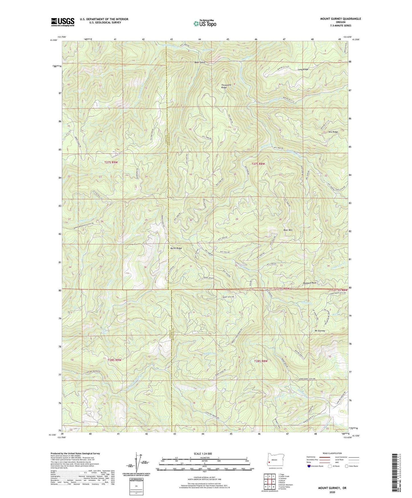
2020 topographic map quadrangle Mount Gurney in the state of Oregon. Scale: 1:24000. Based on the newly updated USGS 7.5' US Topo map series, this map is in the following counties: Douglas, Coos. The map contains contour data, water features, and other items you are used to seeing on USGS maps, but also has updated roads and other features. This is the next generation of topographic maps. Printed on high-quality waterproof paper with UV fade-resistant inks.
Quads adjacent to this one:
West: Sitkum
Northwest: Tioga
North: Cedar Creek
Northeast: Callahan
East: Reston
Southeast: Tenmile
South: Camas Valley
Southwest: Kenyon Mountain
Contains the following named places: Bear Creek, Bear Gulch, Bear Mountain, Bryson Creek, Burnt Ridge, Buzzard Rock, Dave Busenbark County Park, Fivemile Creek, Gooseberry Creek, Knepper Creek, Lost Creek Falls, Mount Gurney, Murry Creek, Panther Creek, Severt Iverson Memorial County Park, Threemile Ridge, Weekly Post Office, Wilson Creek, Yew Ridge