MyTopo
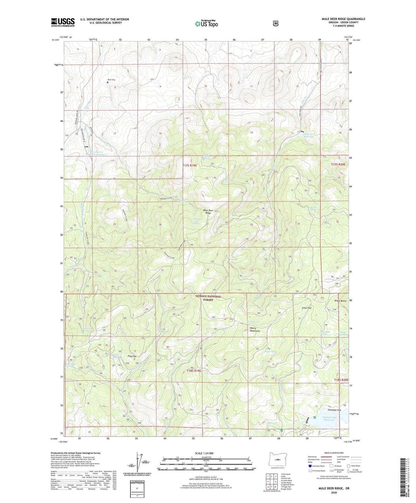
Mule Deer Ridge Oregon US Topo Map
Couldn't load pickup availability
Also explore the Mule Deer Ridge Forest Service Topo of this same quad for updated USFS data
2024 topographic map quadrangle Mule Deer Ridge in the state of Oregon. Scale: 1:24000. Based on the newly updated USGS 7.5' US Topo map series, this map is in the following counties: Crook. The map contains contour data, water features, and other items you are used to seeing on USGS maps, but also has updated roads and other features. This is the next generation of topographic maps. Printed on high-quality waterproof paper with UV fade-resistant inks.
Quads adjacent to this one:
West: Conant Basin
Northwest: Pilot Butte
North: Post
Northeast: Prairie Hill
East: Drake Butte
Southeast: Logan Butte
South: Pringle Flat
Southwest: Sugarloaf Butte
This map covers the same area as the classic USGS quad with code o44120a4.
Contains the following named places: Antelope Flat Dam, Antelope Flat Reservoir, Antelope Flat Reservoir Boat Launch, Antelope Reservoir Recreation Site, Antelope Spring, Badger Spring, Big Fir Spring, Blue Eagle Spring, Chipmunk Spring, Drake Butte, Faught Creek, Flag Flat, Florida Creek, Hammer Creek, Hammer Creek Spring, Knox Cemetery, Knox Spring, Lillie Flat, Maury Mountain Mines, Maury Mountains, Mule Deer Ridge, Mule Deer Spring, Newsome Creek Dam Number 1, Newsome Creek Reservoir Number 1, Pine Creek Campground, Pine Creek Dam, Pine Creek Reservoir, Rarey Spring, Shearing Spring, Sherwood Creek, Sherwood Spring