MyTopo
North Fork Oregon US Topo Map
Couldn't load pickup availability
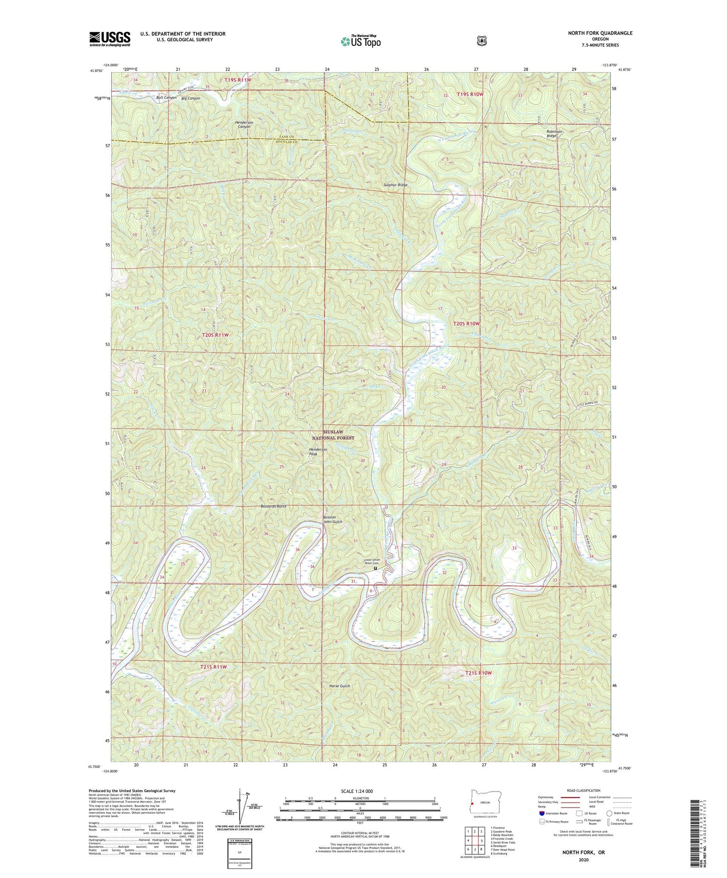
2020 topographic map quadrangle North Fork in the state of Oregon. Scale: 1:24000. Based on the newly updated USGS 7.5' US Topo map series, this map is in the following counties: Douglas, Lane. The map contains contour data, water features, and other items you are used to seeing on USGS maps, but also has updated roads and other features. This is the next generation of topographic maps. Printed on high-quality waterproof paper with UV fade-resistant inks.
Quads adjacent to this one:
West: Fivemile Creek
Northwest: Florence
North: Goodwin Peak
Northeast: Baldy Mountain
East: Smith River Falls
Southeast: Scottsburg
South: Deer Head Point
Southwest: Reedsport
Contains the following named places: Big Canyon, Billy Moore Creek, Bull Canyon, Buzzards Butte, Cassidy Creek, Chapman Creek, Dailey Ranch, Dry Creek, East Fork Eslick Creek, Edmonds Creek, Eslick Creek, Georgia Creek, Harlan Creek, Henderson Canyon, Henderson Peak, Horse Gulch, Johnson Creek, Lower Smith River Cemetery, McKinney Creek, Morris Creek, Murphy Creek, Noel Creek, Noel Ranch Recreation Site, Noel Ranch Recreation Site Boat Launch, Norfolk Post Office, North Fork, North Fork Smith River, Perkins Creek, Railroad Creek, Robinson Ridge, Russian John Gulch, School House County Park Boat Ramp, Smith River Grange, Smith River Marina, Spencer Creek, Straddle Creek, Sulphur Creek, Sulphur Ridge, Sulphur Springs, Sulphur Springs Post Office, Taylor Creek, Wasson Creek, Weiss Ranch, Wroe Post Office