MyTopo
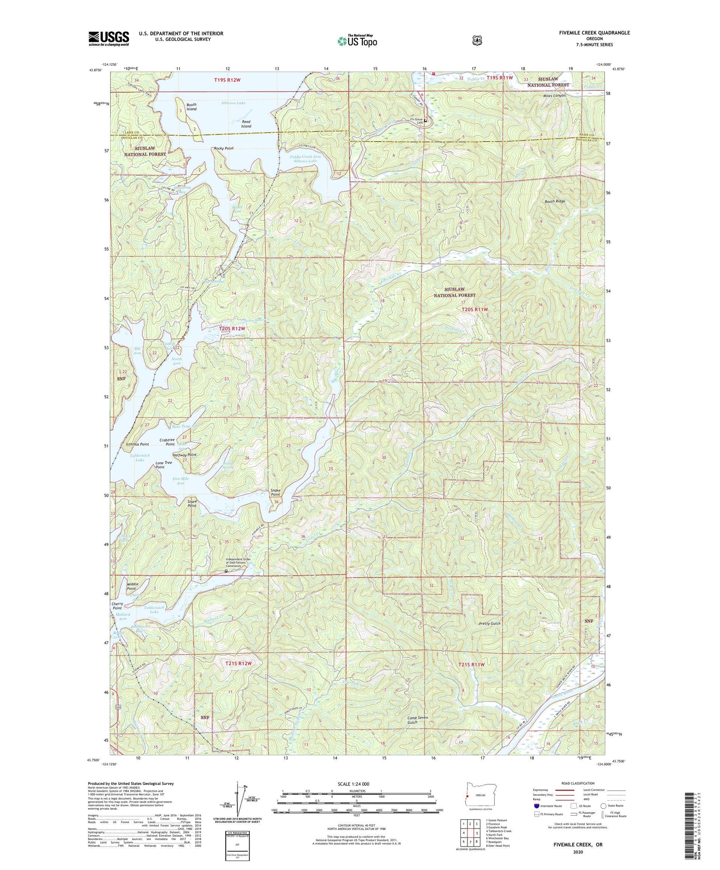
Fivemile Creek Oregon US Topo Map
Couldn't load pickup availability
Also explore the Fivemile Creek Forest Service Topo of this same quad for updated USFS data
2024 topographic map quadrangle Fivemile Creek in the state of Oregon. Scale: 1:24000. Based on the newly updated USGS 7.5' US Topo map series, this map is in the following counties: Douglas, Lane. The map contains contour data, water features, and other items you are used to seeing on USGS maps, but also has updated roads and other features. This is the next generation of topographic maps. Printed on high-quality waterproof paper with UV fade-resistant inks.
Quads adjacent to this one:
West: Tahkenitch Creek
Northwest: Goose Pasture
North: Florence
Northeast: Goodwin Peak
East: North Fork
Southeast: Deer Head Point
South: Reedsport
Southwest: Winchester Bay
This map covers the same area as the classic USGS quad with code o43124g1.
Contains the following named places: Ada, Ada County Park, Ada County Park Boat Ramp, Ada Post Office, Ada Resort Boat Ramp, Ada Station, Alder Creek, Bass, Bear Creek, Bear Trap Arm, Bedolf Arm, Bell Creek, Big Arm, Black Creek, Bombard Bay, Booth, Booth Arm, Booth Island, Booth Landing, Booth Post Office, Booth Ridge, Brenham, Catfish Hole, Cherry Arm, Cherry Point, Cleves Cove, Crabtree Point, Dismal Swamp, Fiddle Creek, Fiddle Creek Arm Siltcoos Lake, Fingerboard Slough Creek, Fir Grove Cemetery, Five Mile Arm, Fivemile Creek, Frarey Creek, Gardiner County Park Boat Ramp / Dock, Gardiner Landing, H P Dutton Lumber Company, Halfway Point, Harmony Bay, Harry Creek, Holden Creek, Independent Order of Odd Fellows Cemeteries, Isthmus Point, John Sims Creek, Joyce Creek, King Creek, Lane Creek, Leitel Creek, Lone Tree Point, Mallard Arm, Mallard Creek, Middle Point, Miles Canyon, North Arm, Patterson Creek, Perkins Creek, Pretty Gulch, Reed Island, Rocky Point, Ruby Post Office, Silver Creek, Siuslaw Valley Fire and Rescue Station 6 Ada Station, Snake Point, Snare Point, Spike Arm, The Isthmus, Young Creek