MyTopo
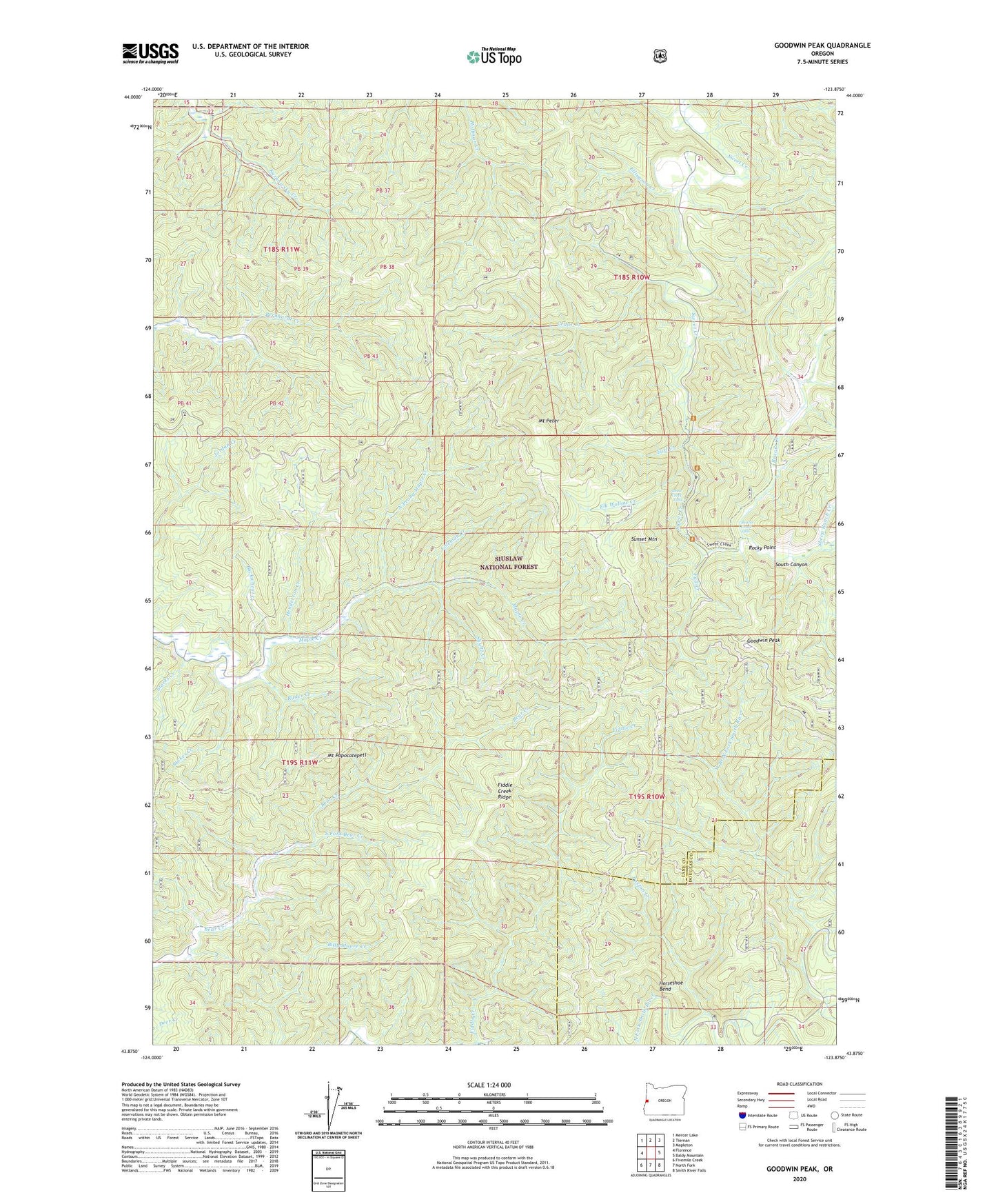
Goodwin Peak Oregon US Topo Map
Couldn't load pickup availability
Also explore the Goodwin Peak Forest Service Topo of this same quad for updated USFS data
2023 topographic map quadrangle Goodwin Peak in the state of Oregon. Scale: 1:24000. Based on the newly updated USGS 7.5' US Topo map series, this map is in the following counties: Lane, Douglas. The map contains contour data, water features, and other items you are used to seeing on USGS maps, but also has updated roads and other features. This is the next generation of topographic maps. Printed on high-quality waterproof paper with UV fade-resistant inks.
Quads adjacent to this one:
West: Florence
Northwest: Mercer Lake
North: Tiernan
Northeast: Mapleton
East: Baldy Mountain
Southeast: Smith River Falls
South: North Fork
Southwest: Fivemile Creek
This map covers the same area as the classic USGS quad with code o43123h8.
Contains the following named places: Beaver Creek, Beaver Creek Falls, Buckwheat Creek, Cedar Creek, Coleman Creek, Earl, Earl Creek, Earl Post Office, Elk Wallow Creek, Ellingson Creek, Fall Creek, Fiddle Creek Ridge, Goodwin Peak, Henderson Creek, Horseshoe Bend, Mount Peter, Mount Popocatepetl, North Prong Maple Creek, Paxton Creek, Rocky Point, Ryder Creek, Sheep Ranch Creek, Shultz Creek, South Canyon, South Fork Bear Creek, Starks Creek, Stokes Creek, Sunrise Ranger Station, Sunset Mountain, Sweet Creek Falls, West Branch North Fork Smith River