MyTopo
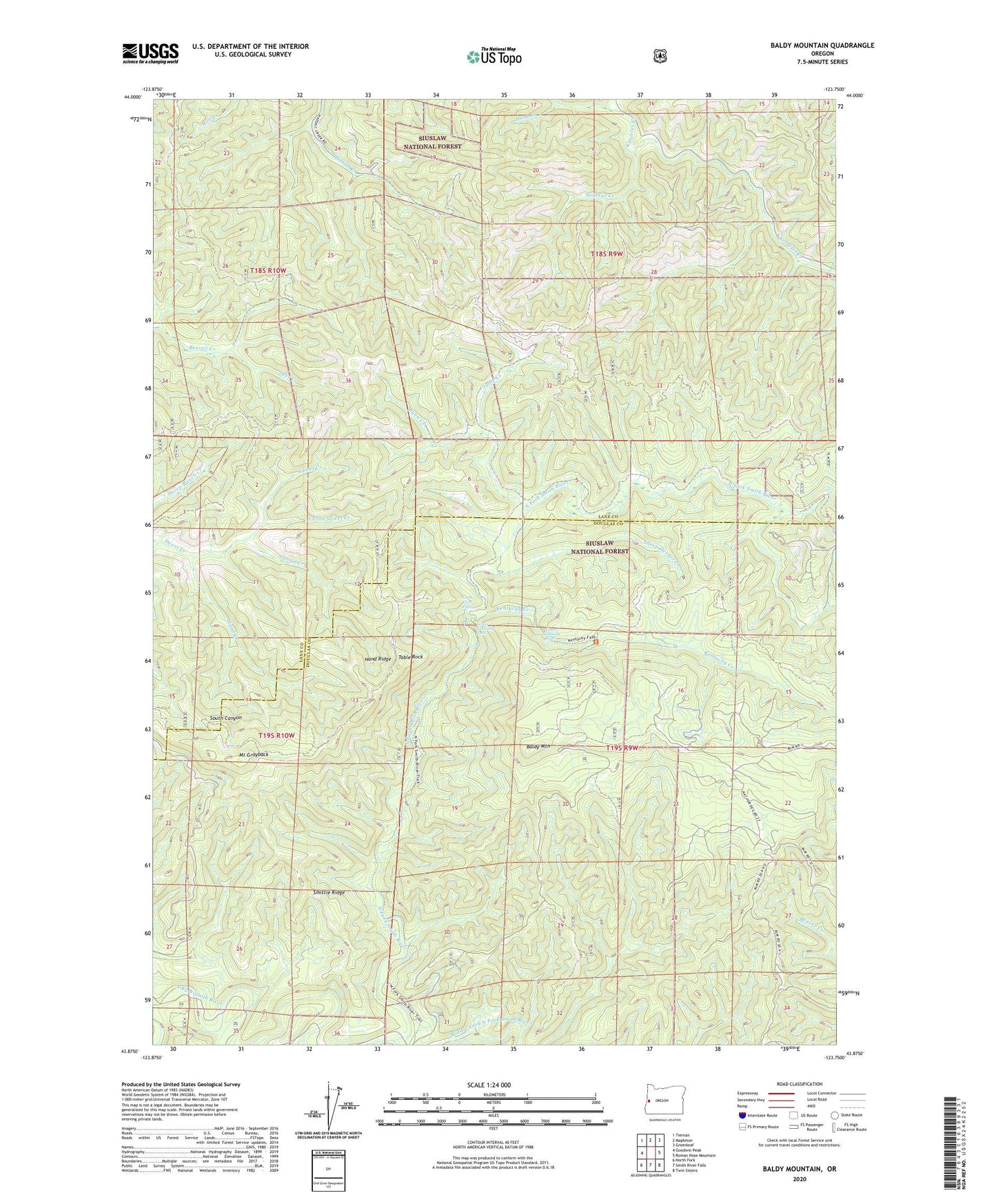
Baldy Mountain Oregon US Topo Map
Couldn't load pickup availability
Also explore the Baldy Mountain Forest Service Topo of this same quad for updated USFS data
2023 topographic map quadrangle Baldy Mountain in the state of Oregon. Scale: 1:24000. Based on the newly updated USGS 7.5' US Topo map series, this map is in the following counties: Lane, Douglas. The map contains contour data, water features, and other items you are used to seeing on USGS maps, but also has updated roads and other features. This is the next generation of topographic maps. Printed on high-quality waterproof paper with UV fade-resistant inks.
Quads adjacent to this one:
West: Goodwin Peak
Northwest: Tiernan
North: Mapleton
Northeast: Greenleaf
East: Roman Nose Mountain
Southeast: Twin Sisters
South: Smith River Falls
Southwest: North Fork
This map covers the same area as the classic USGS quad with code o43123h7.
Contains the following named places: Baldy Mountain, Deer Creek, Hand Creek, Hand Ridge, Hood Creek, Jump Creek, Kentucky Creek, Lloyd Creek, Lower Kentucky Falls, Middle Fork North Fork Smith River, Mount Grayback, North Fork Falls, Ord Post Office, Ryan Creek, Sheep Herder Creek, Smith River Recreation Site, Smittie Ridge, South Fork Sweet Creek, Sulphur Creek, Table Rock, Upper Kentucky Falls, ZIP Code: 97453