MyTopo
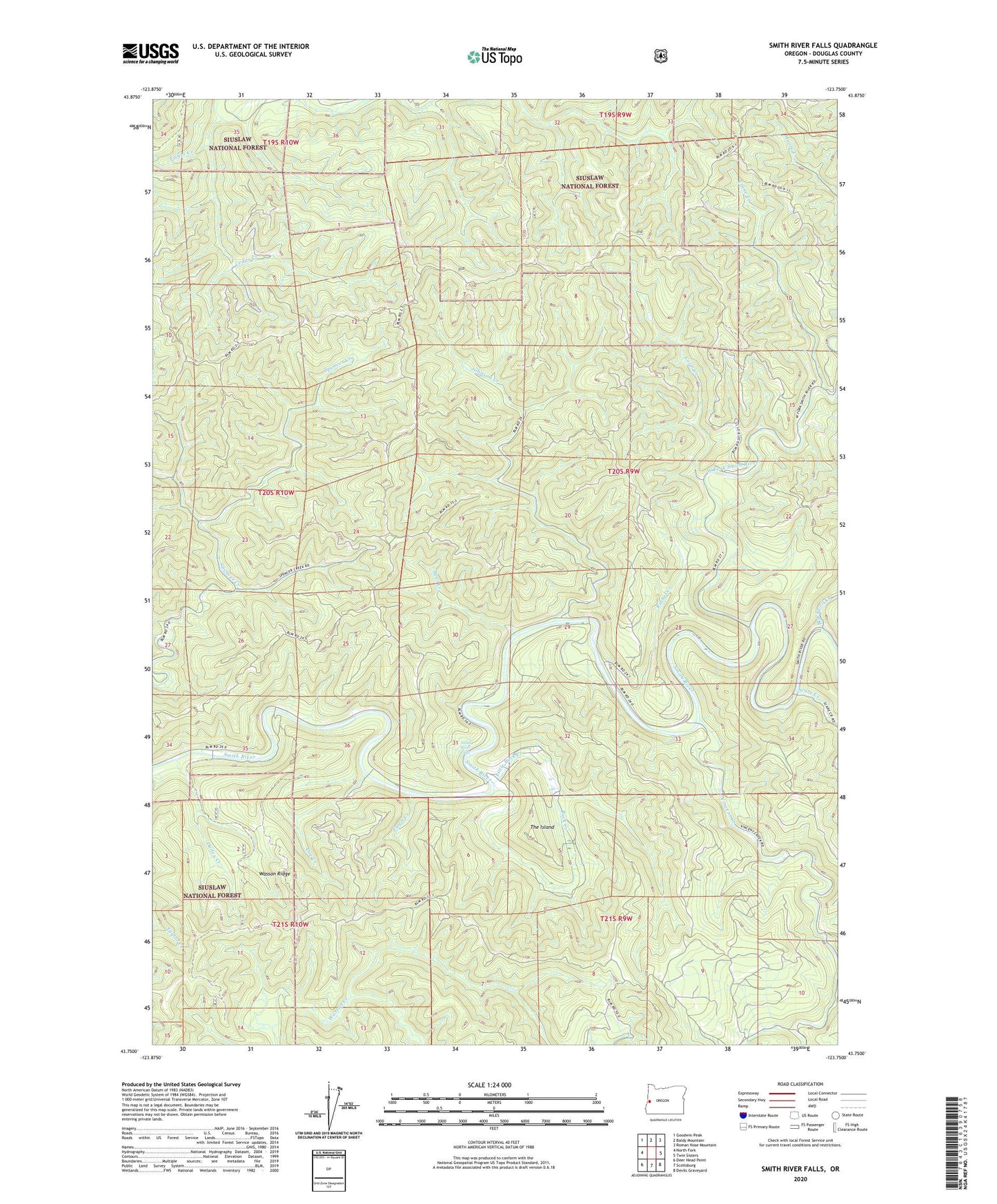
Smith River Falls Oregon US Topo Map
Couldn't load pickup availability
Also explore the Smith River Falls Forest Service Topo of this same quad for updated USFS data
2024 topographic map quadrangle Smith River Falls in the state of Oregon. Scale: 1:24000. Based on the newly updated USGS 7.5' US Topo map series, this map is in the following counties: Douglas. The map contains contour data, water features, and other items you are used to seeing on USGS maps, but also has updated roads and other features. This is the next generation of topographic maps. Printed on high-quality waterproof paper with UV fade-resistant inks.
Quads adjacent to this one:
West: North Fork
Northwest: Goodwin Peak
North: Baldy Mountain
Northeast: Roman Nose Mountain
East: Twin Sisters
Southeast: Devils Graveyard
South: Scottsburg
Southwest: Deer Head Point
This map covers the same area as the classic USGS quad with code o43123g7.
Contains the following named places: Bear Creek, Blackwell Creek, Buck Creek, Cedar Creek, Clearwater Creek, Coon Creek, Crane Creek, Dailey Creek, Doe Creek, Dog Creek, Fawn Creek, Fawn Creek Recreation Site, Fisher Creek, Johnson Creek, Little Buck Creek, Rachel Creek, Scare Creek, Smith River Falls, The Island, Vincent Creek, Vincent Creek Guard Station, Vincent Creek Recreation Site, Wasson Ridge, West Fork Smith River, ZIP Code: 97467