MyTopo
North Sister Oregon US Topo Map
Couldn't load pickup availability
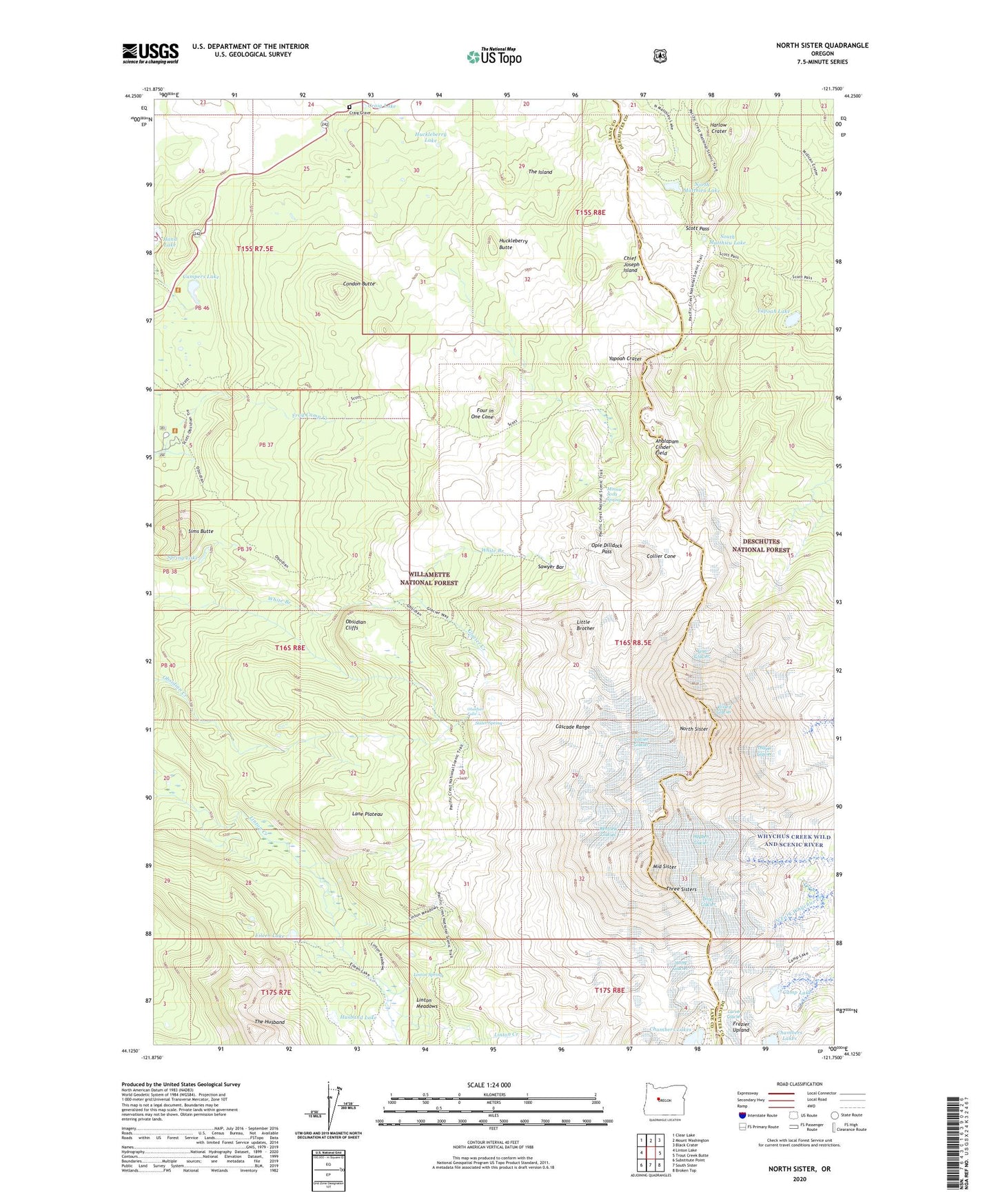
2020 topographic map quadrangle North Sister in the state of Oregon. Scale: 1:24000. Based on the newly updated USGS 7.5' US Topo map series, this map is in the following counties: Lane, Deschutes. The map contains contour data, water features, and other items you are used to seeing on USGS maps, but also has updated roads and other features. This is the next generation of topographic maps. Printed on high-quality waterproof paper with UV fade-resistant inks.
Quads adjacent to this one:
West: Linton Lake
Northwest: Clear Lake
North: Mount Washington
Northeast: Black Crater
East: Trout Creek Butte
Southeast: Broken Top
South: South Sister
Southwest: Substitute Point
Contains the following named places: Ahalapam Cinder Field, Bronaugh Memorial Plaque, Camp Lake, Campers Lake, Carver Glacier, Chambers Lakes, Chief Joseph Island, Collier Cone, Collier Glacier, Collier Glacier View, Condon Butte, Craig Grave, Craig Lake, Diller Glacier, Eileen Lake, Four in One Cone, Frog Camp, Glacier Creek, Glacier Way, Harlow Crater, Hayden Glacier, Huckleberry Butte, Huckleberry Lake, Husband Lake, Irving Glacier, Lane Plateau, Linn Glacier, Linton Meadows, Linton Spring, Little Brother, Matthieu Lakes, Middle Sister, Millican Crater Trail, Minnie Scott Spring, Montague Memorial Plaque, North Matthieu Lake, North Sister, Obsidian Cliffs, Obsidian Falls, Obsidian Trail, Opie Dilldock Pass, Prouty Memorial Plaque, Renfrew Glacier, Sawyer Bar, Scott Pass, Scott Trail, Sims Butte, Sister Spring, South Matthieu Lake, Spring Lake, Thayer Glacier, The Husband, The Island, Villard Glacier, West Lava Creek, West Lava Forest Camp, Yapoah Crater, Yapoah Lake