MyTopo
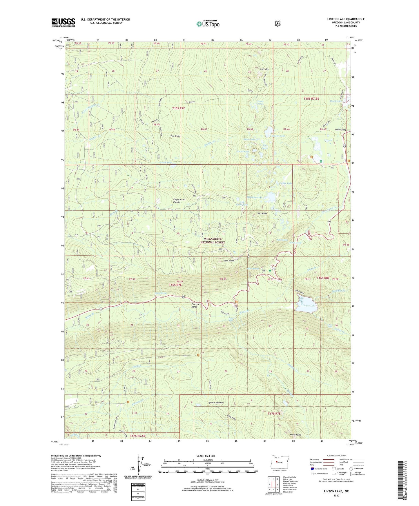
Linton Lake Oregon US Topo Map
Couldn't load pickup availability
Also explore the Linton Lake Forest Service Topo of this same quad for updated USFS data
2024 topographic map quadrangle Linton Lake in the state of Oregon. Scale: 1:24000. Based on the newly updated USGS 7.5' US Topo map series, this map is in the following counties: Lane. The map contains contour data, water features, and other items you are used to seeing on USGS maps, but also has updated roads and other features. This is the next generation of topographic maps. Printed on high-quality waterproof paper with UV fade-resistant inks.
Quads adjacent to this one:
West: Belknap Springs
Northwest: Tamolitch Falls
North: Clear Lake
Northeast: Mount Washington
East: North Sister
Southeast: South Sister
South: Substitute Point
Southwest: French Mountain
This map covers the same area as the classic USGS quad with code o44121b8.
Contains the following named places: Alder Springs, Alder Springs Recreation Site, Benson Lake, Benson Trail, Butler Spring, Butte Spring, Camp Melakwa, Coffee Lake, Deer Butte, Elf Lake, Fingerboard Prairie, Foley Ridge, Frog Camp Creek, Glaze Lake, Gold Creek, Hand Lake, Hand Lake Shelter, Hand Lake Trail, Irish Camp Lake, Island Lake, Knobs Sheep Camp, Lake Valley, Linton Creek, Linton Falls, Linton Lake, Lower Alder Springs Forest Camp, Melakwa Boy Scout Camp, Melakwa Lake, Obsidian Creek, Payne Spring, Prince Lake, Proxy Creek, Proxy Falls, Proxy Point, Scott Lake, Scott Lake Recreation Site, Scott Mountain, Shadow Creek, Spruce Meadow, Tenas Lakes, The Knobs, Two Butte, White Branch Youth Camp