
MyTopo
Oak Creek Valley Oregon US Topo Map
Couldn't load pickup availability
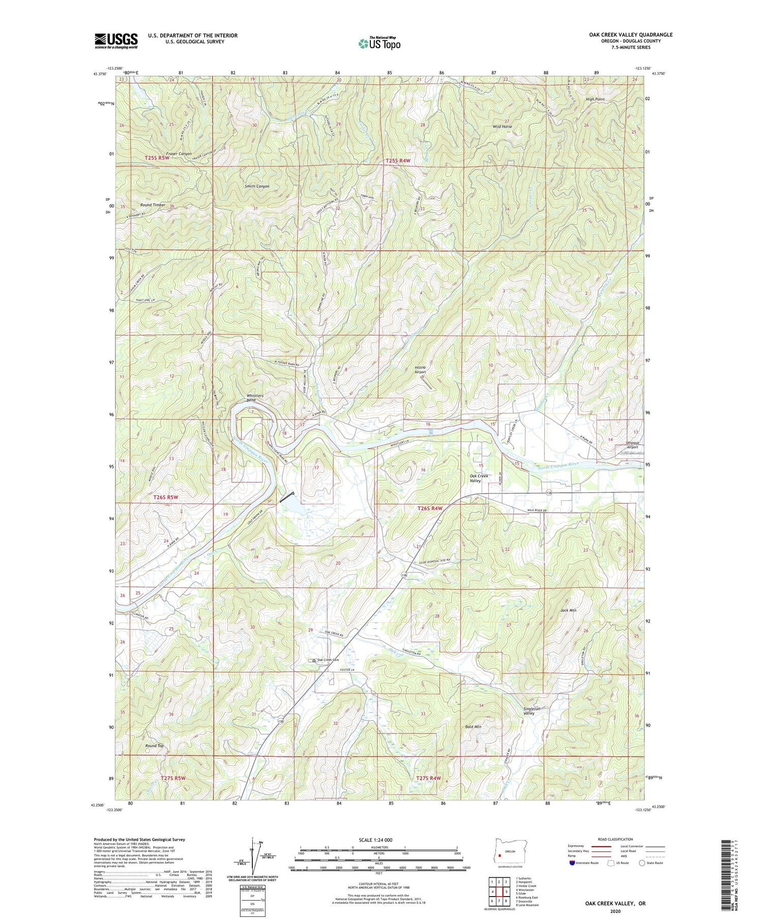
2020 topographic map quadrangle Oak Creek Valley in the state of Oregon. Scale: 1:24000. Based on the newly updated USGS 7.5' US Topo map series, this map is in the following counties: Douglas. The map contains contour data, water features, and other items you are used to seeing on USGS maps, but also has updated roads and other features. This is the next generation of topographic maps. Printed on high-quality waterproof paper with UV fade-resistant inks.
Quads adjacent to this one:
West: Winchester
Northwest: Sutherlin
North: Nonpareil
Northeast: Hinkle Creek
East: Glide
Southeast: Lane Mountain
South: Dixonville
Southwest: Roseburg East
Contains the following named places: Bald Mountain, Bull Creek, Cooper Creek, Denley Reservoir, Douglas County, Fordice Creek, High Point, Hilltop Airport, Huntley Creek, Jack Mountain, Jackson Creek, Mount Scott Post Office, Oak Creek, Oak Creek Cemetery, Oak Creek Post Office, Oak Creek Valley, Robinson Post Office, Round Timber, Round Top, Singleton Valley, Umpqua Airport, V T Jackson County Wayside, Whistler Bend County Park, Whistlers Bend, Whistlers Bend County Park Boat Ramp, Whistlers Bend Dam, Whistlers Bend Reservoir, Wild Horse, ZIP Code: 97470


