MyTopo
Ophir Mountain Oregon US Topo Map
Couldn't load pickup availability
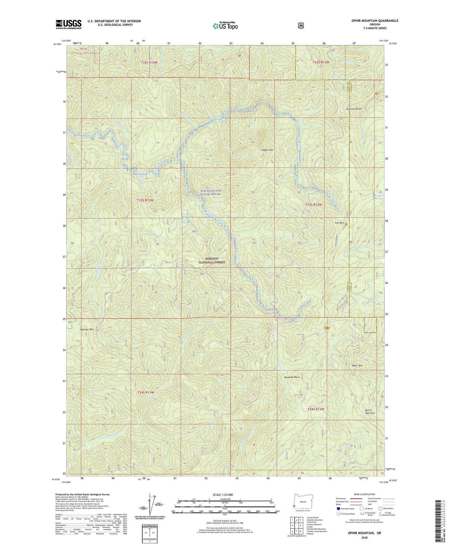
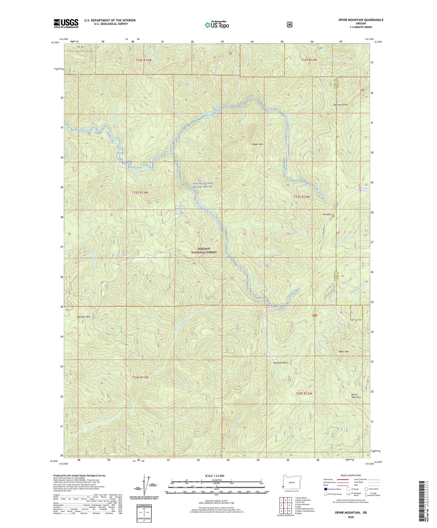
2020 topographic map quadrangle Ophir Mountain in the state of Oregon. Scale: 1:24000. Based on the newly updated USGS 7.5' US Topo map series, this map is in the following counties: Curry, Coos. The map contains contour data, water features, and other items you are used to seeing on USGS maps, but also has updated roads and other features. This is the next generation of topographic maps. Printed on high-quality waterproof paper with UV fade-resistant inks.
Quads adjacent to this one:
West: Father Mountain
Northwest: Mount Butler
North: Barklow Mountain
Northeast: China Flat
East: Illahe
Southeast: Agness
South: Soldier Camp Mountain
Southwest: Brushy Bald Mountain
Contains the following named places: Blackberry Creek, Bonanza Basin, Bungalow Creek, Camp Victoria, Copper Mountain, Copper Salmon Wilderness, Devils Half Acre, Iron Mountain, Laird Lake, Laird Lake Recreation Site, Marys Creek, McCurdy Campground, McCurdy Creek, Mud Lake, North Fork Elk River, Ophir Mountain, Panther Mountain, Slide Creek, South Fork Elk River, Toast Camp