MyTopo
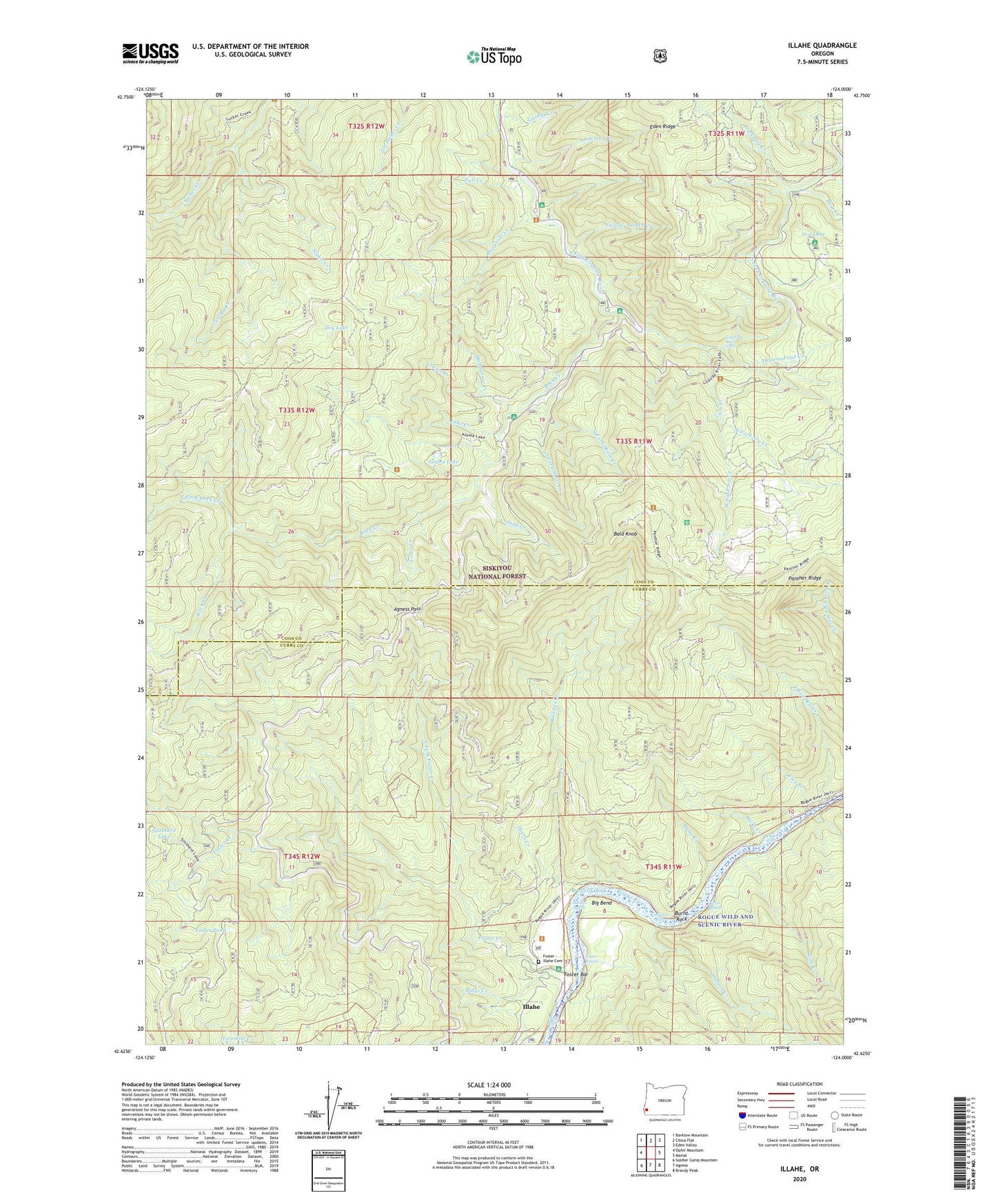
Illahe Oregon US Topo Map
Couldn't load pickup availability
Also explore the Illahe Forest Service Topo of this same quad for updated USFS data
2023 topographic map quadrangle Illahe in the state of Oregon. Scale: 1:24000. Based on the newly updated USGS 7.5' US Topo map series, this map is in the following counties: Coos, Curry. The map contains contour data, water features, and other items you are used to seeing on USGS maps, but also has updated roads and other features. This is the next generation of topographic maps. Printed on high-quality waterproof paper with UV fade-resistant inks.
Quads adjacent to this one:
West: Ophir Mountain
Northwest: Barklow Mountain
North: China Flat
Northeast: Eden Valley
East: Marial
Southeast: Brandy Peak
South: Agness
Southwest: Soldier Camp Mountain
This map covers the same area as the classic USGS quad with code o42124f1.
Contains the following named places: Agness Division, Agness Pass, Anderson Creek, Azalea Lake, Bald Knob, Bear Creek, Big Bend, Billings Creek, Billings Rapids, Billys Creek, Brewery Hole, Burnt Rapids, Burnt Rock, Chrome Creek, Coquille River Falls, Coquille River Falls Natural Area, Crater Creek, Dads Lake, Dans Creek, Daphne Grove Recreation Site, Doerr Creek, Drowned Out Creek, Dry Lake, East Fork Sru Creek, Fall Creek, Ferris Ford Work Center, Fives Creek, Flea Creek, Flora Dell Creek, Flora Dell Recreation Site, Foster - Illahe Cemetery, Foster Bar, Foster Bar Boat Launch, Foster Bar Recreation Site, Foster Creek, Foster Pond, Foster Rapids, Hicks Creek, Hosposki Creek, Illahe, Illahe Lodge, Illahe Post Office, Illahe Recreation Site, Illahe Riffle, Independence Mine, Island Recreation Site, Lake Creek, Lockhart Creek, Manganese Creek, Mountain Wells Trail, Nickel Creek, North Fork Foster Creek, North Fork Rock Creek, North Fork Shale Creek, Payton Riffle, Peacock Recreation Site, Port Orford Cedar Experimental Forest, Rock Creek, Rock Creek Recreation Site, Sand Creek, Slide Creek, South Fork Shale Creek, Southard Lake, Sru Creek, Sru Lake, Sru Lake Campground, Two-Bit Creek, Watson Creek, Watson Riffle, West Fork Sru Creek, Yellow Jacket Creek