
MyTopo
Brushy Bald Mountain Oregon US Topo Map
Couldn't load pickup availability
Also explore the Brushy Bald Mountain Forest Service Topo of this same quad for updated USFS data
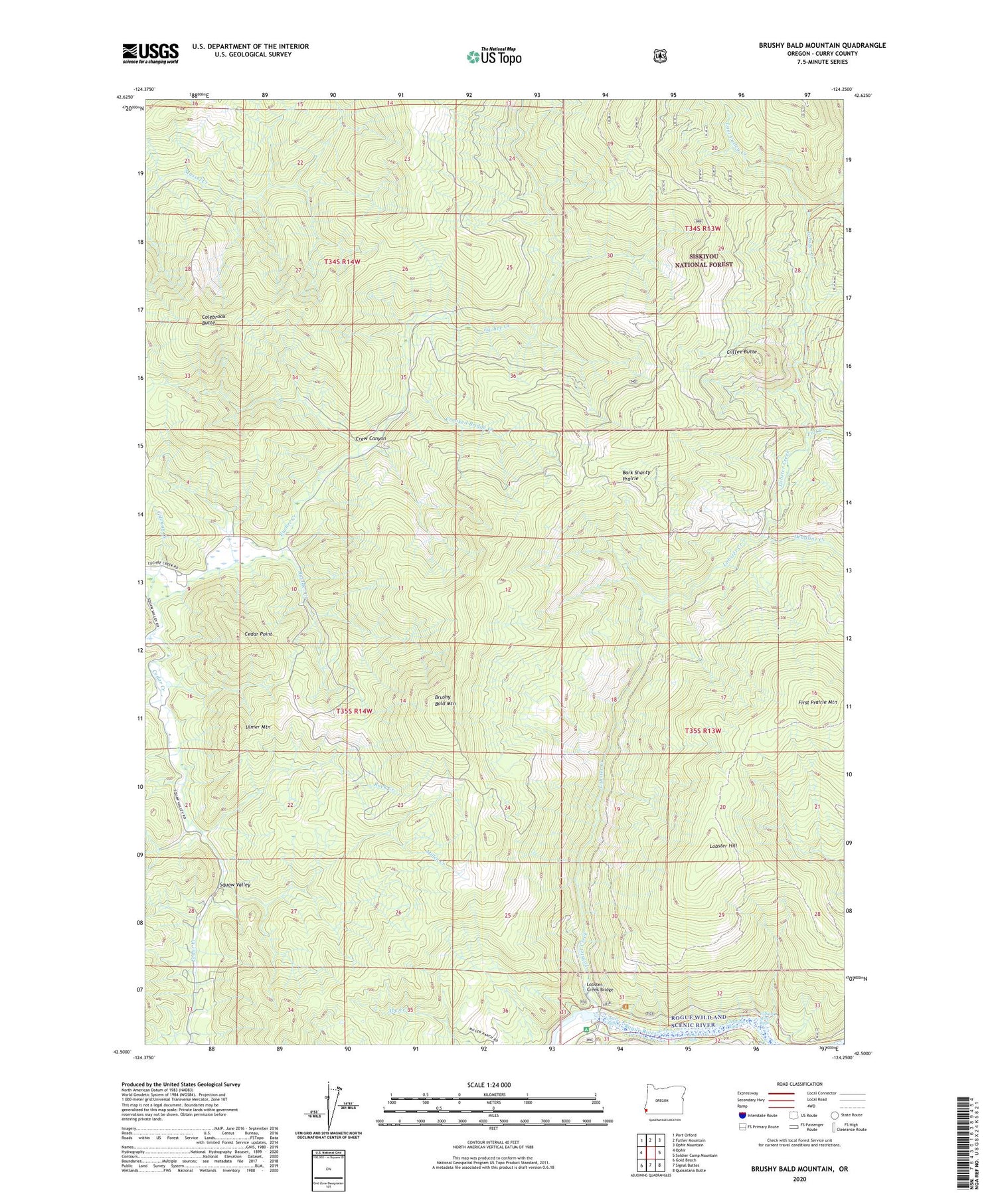
2023 topographic map quadrangle Brushy Bald Mountain in the state of Oregon. Scale: 1:24000. Based on the newly updated USGS 7.5' US Topo map series, this map is in the following counties: Curry. The map contains contour data, water features, and other items you are used to seeing on USGS maps, but also has updated roads and other features. This is the next generation of topographic maps. Printed on high-quality waterproof paper with UV fade-resistant inks.
Quads adjacent to this one:
West: Ophir
Northwest: Port Orford
North: Father Mountain
Northeast: Ophir Mountain
East: Soldier Camp Mountain
Southeast: Quosatana Butte
South: Signal Buttes
Southwest: Gold Beach
This map covers the same area as the classic USGS quad with code o42124e3.
Contains the following named places: Bark Shanty Prairie, Boulder Creek, Brushy Bald Mountain, Cedar Creek, Cedar Point, Coffee Butte, Colebrook Butte, Crew Canyon, Crew Canyon Creek, Crooked Bridge Creek, Deadline Creek, Euchre Creek Pond, Fall Creek, First Prairie Mountain, Gillman Creek, Jennings Riffle, Lobster Bar, Lobster Creek, Lobster Creek Boat Ramp, Lobster Creek Bridge, Lobster Creek Recreation Site, Lobster Hill, Lobster Riffle, Lost Valley Creek, Miller Creek, Rock Creek, Scow Riffle, Sherman Ranch, Squaw Valley, Ulmer Mountain, William Miller Riffle, ZIP Code: 97444


