MyTopo
Page Springs Oregon US Topo Map
Couldn't load pickup availability
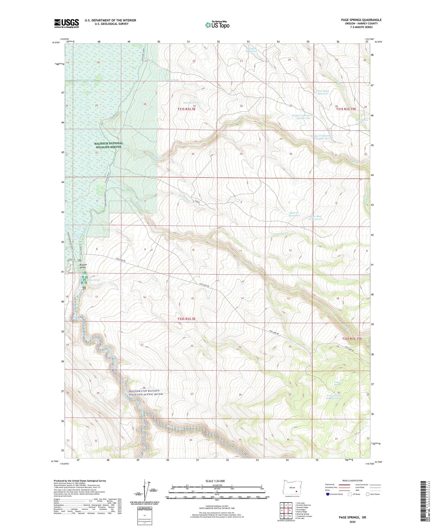
2024 topographic map quadrangle Page Springs in the state of Oregon. Scale: 1:24000. Based on the newly updated USGS 7.5' US Topo map series, this map is in the following counties: Harney. The map contains contour data, water features, and other items you are used to seeing on USGS maps, but also has updated roads and other features. This is the next generation of topographic maps. Printed on high-quality waterproof paper with UV fade-resistant inks.
Quads adjacent to this one:
West: Frenchglen
Northwest: Irish Lake
North: Krumbo Reservoir
Northeast: Krumbo Ridge
East: McCoy Ridge
Southeast: Fish Lake
South: Tombstone Canyon
Southwest: Roaring Springs
This map covers the same area as the classic USGS quad with code o42118g7.
Contains the following named places: Bridge Creek, Bridge Creek Canal, Bridge Creek Reservoir Number One, Bridge Creek Reservoir Number Two, Butte Creek Reservoir, Company Trough, East Rim Reservoir, East Side Canal, End Reservoir, Fish Creek, Frazier Field Reservoir, Frazier Spring, Knox Spring, Knox Spring Reservoir, Lambing Creek, Little Mud Creek Reservoir, Mud Creek, New Road Reservoir, Page Dam, Page Springs, Page Springs Recreation Site, Steens Mountain Cooperative Management and Protection Area, Witzel Spring