MyTopo
Frenchglen Oregon US Topo Map
Couldn't load pickup availability
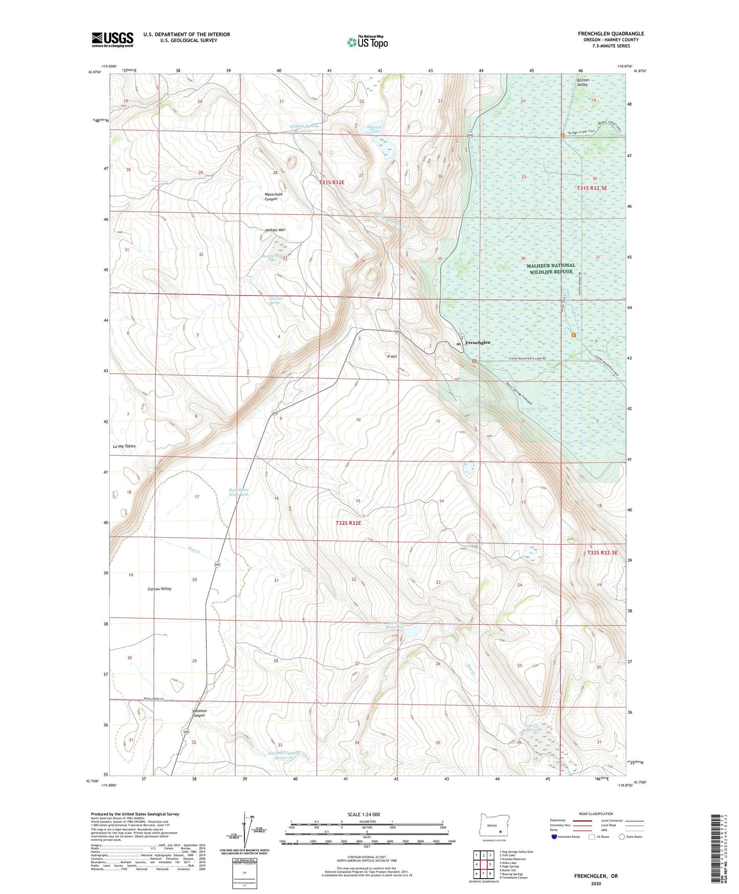
2024 topographic map quadrangle Frenchglen in the state of Oregon. Scale: 1:24000. Based on the newly updated USGS 7.5' US Topo map series, this map is in the following counties: Harney. The map contains contour data, water features, and other items you are used to seeing on USGS maps, but also has updated roads and other features. This is the next generation of topographic maps. Printed on high-quality waterproof paper with UV fade-resistant inks.
Quads adjacent to this one:
West: Walls Lake
Northwest: Keg Springs Valley East
North: Irish Lake
Northeast: Krumbo Reservoir
East: Page Springs
Southeast: Tombstone Canyon
South: Roaring Springs
Southwest: Butler Hill
This map covers the same area as the classic USGS quad with code o42118g8.
Contains the following named places: Antelope Spring, Boardgate Waterhole, Brenton Cabin, Colt Waterhole, Dry Creek, Dry Creek Reservoir, Fred Wicker Place, Frenchglen, Frenchglen Elementary School, Frenchglen Hotel State Park, Frenchglen Post Office, Griffith Spring Reservoir, Jack Fine Place, Kundert Place, Kundert Reservoir, La Voy Tables, M Glenn Place, Mustang Waterhole, P Hill, P Ranch, Peanut Lake, Pickett Corrals, Savoy Lake, Solomon Canyon, Solomon Canyon Reservoir, Warm Springs, Warm Springs Canal, Warm Springs Creek