MyTopo
Painted Hills Oregon US Topo Map
Couldn't load pickup availability
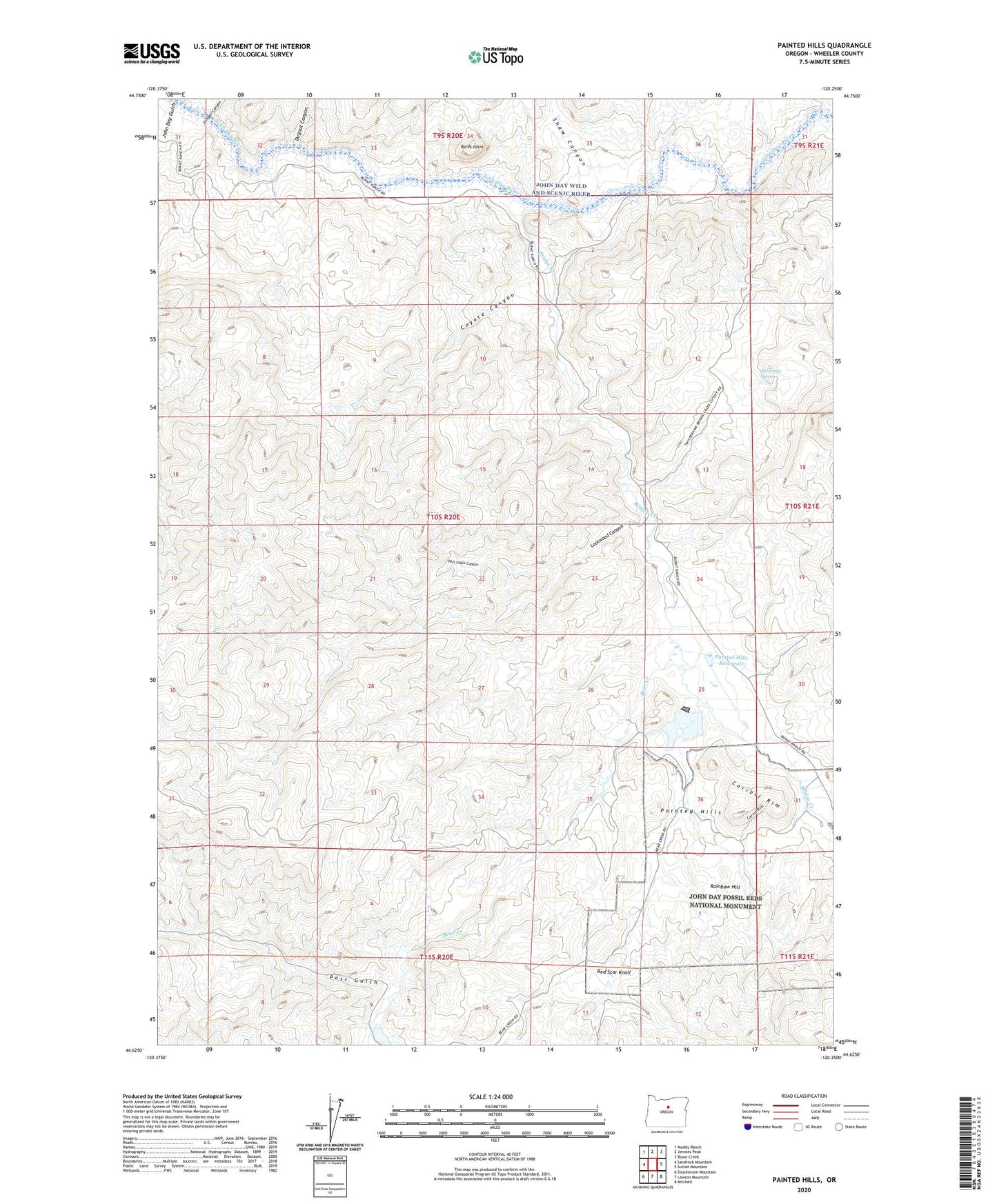
2020 topographic map quadrangle Painted Hills in the state of Oregon. Scale: 1:24000. Based on the newly updated USGS 7.5' US Topo map series, this map is in the following counties: Wheeler. The map contains contour data, water features, and other items you are used to seeing on USGS maps, but also has updated roads and other features. This is the next generation of topographic maps. Printed on high-quality waterproof paper with UV fade-resistant inks.
Quads adjacent to this one:
West: Sandrock Mountain
Northwest: Muddy Ranch
North: Jennies Peak
Northeast: Rowe Creek
East: Sutton Mountain
Southeast: Mitchell
South: Lawson Mountain
Southwest: Stephenson Mountain
Contains the following named places: Bear Creek, Bridge Creek, Bridge Creek Post Office, Brown Grotto, Burnt Ranch, Burnt Ranch Boat Ramp, Burnt Ranch Post Office, Byrds Point, Carroll Rim, Coyote Canyon, Dugout Canyon, John Day Gulch, Juniper Canyon, Lockwood Canyon, Painted Hills, Painted Hills Dam, Painted Hills Reservoir, Painted Hills State Park, Pass Gulch, Pats Cabin Canyon, Priest Hole Boat Launch, Rainbow Hill, Red Scar Knoll, Seward Post Office, Shaw Canyon, Stovepipe Spring, Taylor Ranch