MyTopo
Peoria Oregon US Topo Map
Couldn't load pickup availability
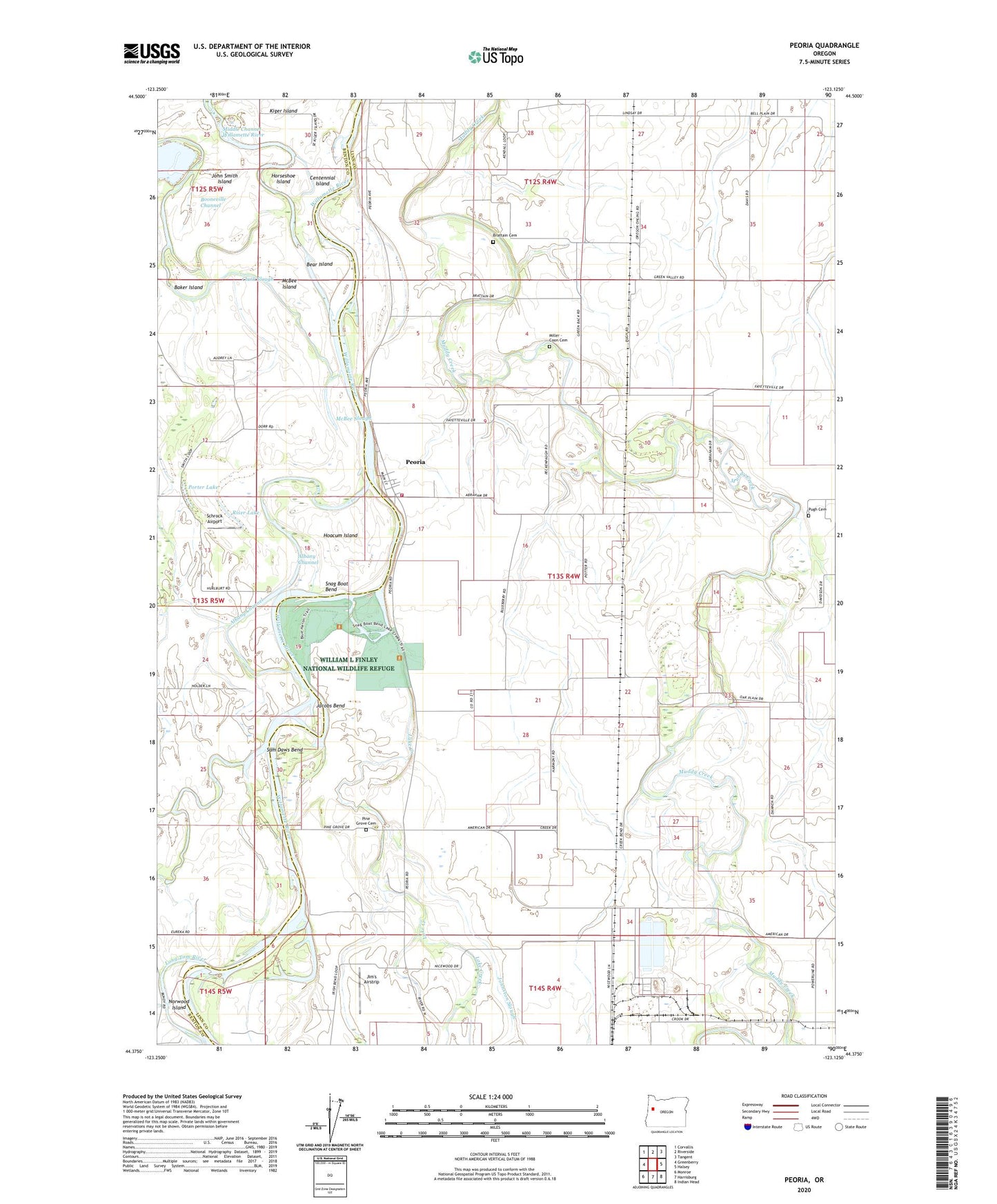
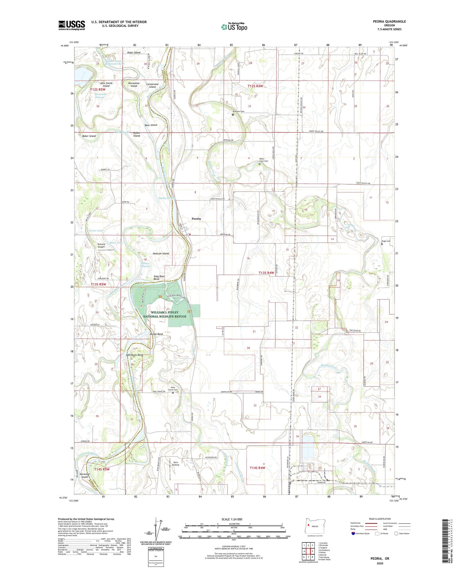
2020 topographic map quadrangle Peoria in the state of Oregon. Scale: 1:24000. Based on the newly updated USGS 7.5' US Topo map series, this map is in the following counties: Linn, Benton. The map contains contour data, water features, and other items you are used to seeing on USGS maps, but also has updated roads and other features. This is the next generation of topographic maps. Printed on high-quality waterproof paper with UV fade-resistant inks.
Quads adjacent to this one:
West: Greenberry
Northwest: Corvallis
North: Riverside
Northeast: Tangent
East: Halsey
Southeast: Indian Head
South: Harrisburg
Southwest: Monroe
Contains the following named places: Albany Channel, American, Baker Island, Bear Island, Bellplain, Brattain Cemetery, Burlington, Burlington Post Office, Camous Creek, Centennial Island, Clark Slough, Faybell, Fayetteville, Halsey Sewage Treatment Facility, Hoacum Island, Horseshoe Island, Jacobs Bend, Jim's Airstrip, Johnston Slough, Lake Creek, Long Tom River, McBee Island, McBee Slough, Miller - Coon Cemetery, Munson, Norwood Island, Peoria, Peoria Census Designated Place, Peoria County Park, Peoria County Park Boat Ramp, Peoria Post Office, Peoria Station 53, Pine Grove Cemetery, Porter Lake, Potter, Pugh Cemetery, Pugh Landing Strip, Riser Lake, Sam Daws Bend, Schrock Airport, Snag Boat Bend, Texaco Refining and Marketing, Tulsa