
MyTopo
Picture Gorge East Oregon US Topo Map
Couldn't load pickup availability
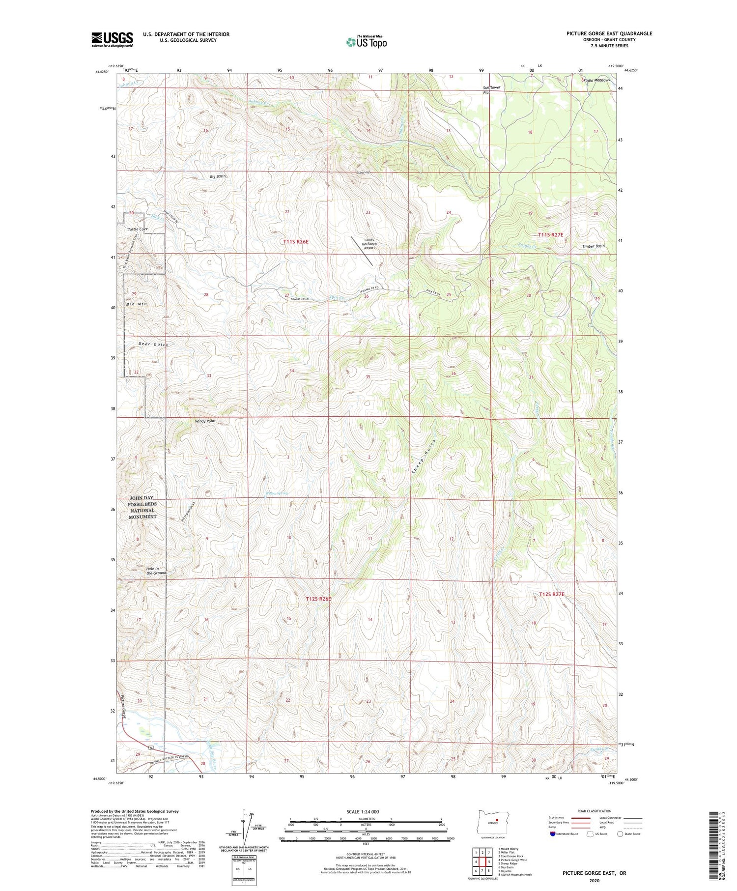
2020 topographic map quadrangle Picture Gorge East in the state of Oregon. Scale: 1:24000. Based on the newly updated USGS 7.5' US Topo map series, this map is in the following counties: Grant. The map contains contour data, water features, and other items you are used to seeing on USGS maps, but also has updated roads and other features. This is the next generation of topographic maps. Printed on high-quality waterproof paper with UV fade-resistant inks.
Quads adjacent to this one:
West: Picture Gorge West
Northwest: Mount Misery
North: Miller Flat
Northeast: Courthouse Rock
East: Sheep Ridge
Southeast: Aldrich Mountain North
South: Dayville
Southwest: Day Basin
Contains the following named places: Big Basin, Cottonwood Creek, Erickson Mill, Hole in the Ground, Land's Inn Ranch Airport, Mascall Ranch, Middle Mountain, Old Kennedy Cabin, Old Watkins Cabin, Rattlesnake Creek, Sheep Gulch, Sugarloaf, Turtle Cove, Willow Spring, Windy Point


