MyTopo
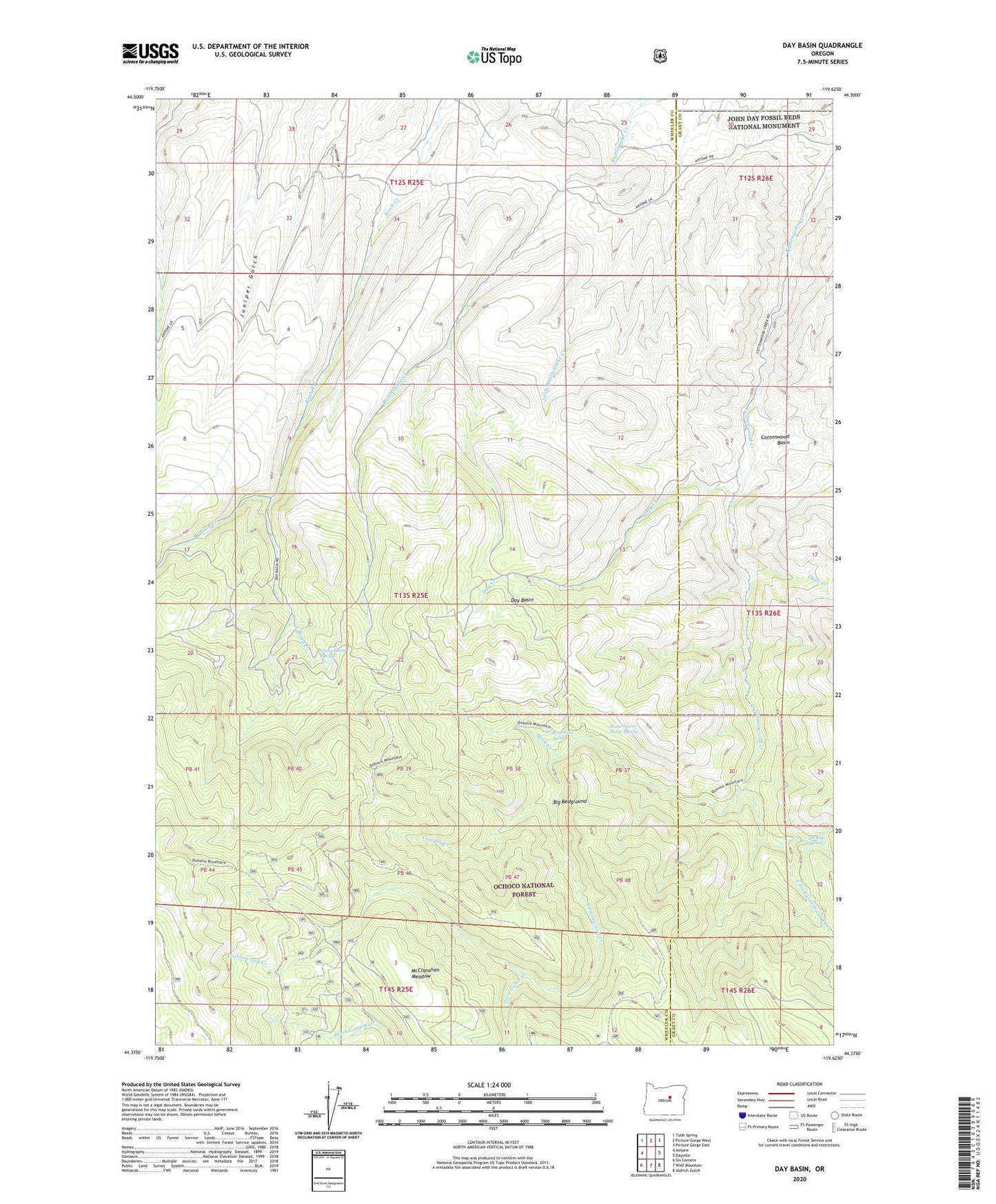
Day Basin Oregon US Topo Map
Couldn't load pickup availability
Also explore the Day Basin Forest Service Topo of this same quad for updated USFS data
2024 topographic map quadrangle Day Basin in the state of Oregon. Scale: 1:24000. Based on the newly updated USGS 7.5' US Topo map series, this map is in the following counties: Wheeler, Grant. The map contains contour data, water features, and other items you are used to seeing on USGS maps, but also has updated roads and other features. This is the next generation of topographic maps. Printed on high-quality waterproof paper with UV fade-resistant inks.
Quads adjacent to this one:
West: Antone
Northwest: Tubb Spring
North: Picture Gorge West
Northeast: Picture Gorge East
East: Dayville
Southeast: Aldrich Gulch
South: Wolf Mountain
Southwest: Six Corners
This map covers the same area as the classic USGS quad with code o44119d6.
Contains the following named places: A and M Ridge, Back Creek, Barite Post Office, Big Bedground, Black Canyon Camp, Breathing Spring, China Camp Spring, Cottonwood Basin, Cougar Creek, Cougar Ridge, Day Basin, Day Creek, Dyke Creek, East Birch Creek, East Fork Cottonwood Creek, Home Sweet Home Spring, Kangaroo Basin, Lost Cabin Creek, McClanahan Meadow, Red Gulch, Still Gulch, Tennessee Gulch, Tin Cup Spring, West Birch Creek, Windy Point