MyTopo
Mount Misery Oregon US Topo Map
Couldn't load pickup availability
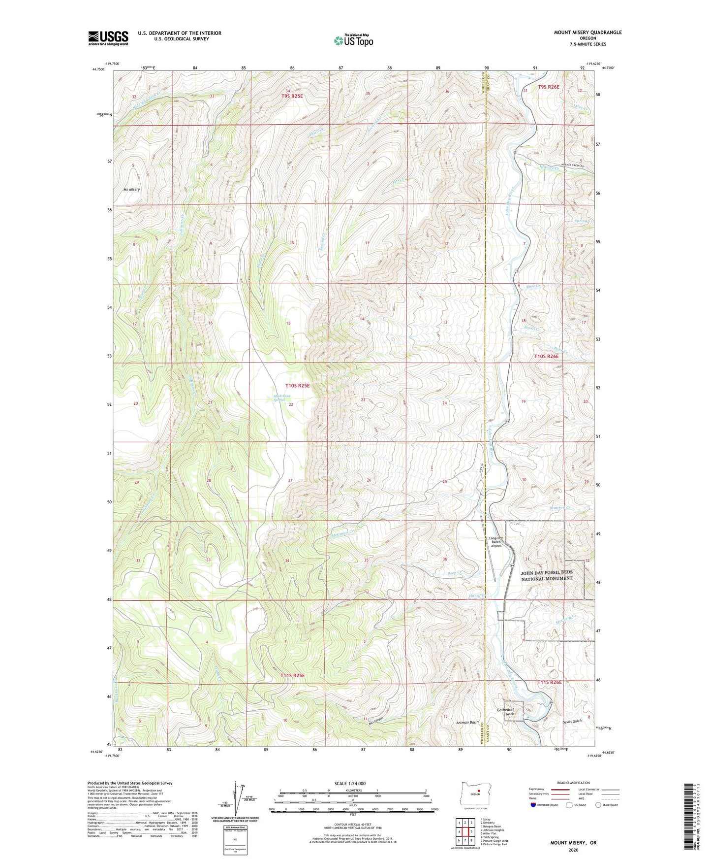
2023 topographic map quadrangle Mount Misery in the state of Oregon. Scale: 1:24000. Based on the newly updated USGS 7.5' US Topo map series, this map is in the following counties: Wheeler, Grant. The map contains contour data, water features, and other items you are used to seeing on USGS maps, but also has updated roads and other features. This is the next generation of topographic maps. Printed on high-quality waterproof paper with UV fade-resistant inks.
Quads adjacent to this one:
West: Johnson Heights
Northwest: Spray
North: Kimberly
Northeast: Bologna Basin
East: Miller Flat
Southeast: Picture Gorge East
South: Picture Gorge West
Southwest: Tubb Spring
This map covers the same area as the classic USGS quad with code o44119f6.
Contains the following named places: Basin Post Office, Bear Creek, Black Snag Springs, Bone Creek, Branson Creek, Bull Canyon, Cathedral Rock, Deep Creek, Devils Gulch, First Creek, Fossil Creek, Gus Creek, Harry Creek, Hide and Seek Creek, Holmes Creek, Johnson Creek, Longview Ranch Airport, McCarty Creek, McGinnis Creek, Mount Misery, Rose Creek, Spring Creek