MyTopo
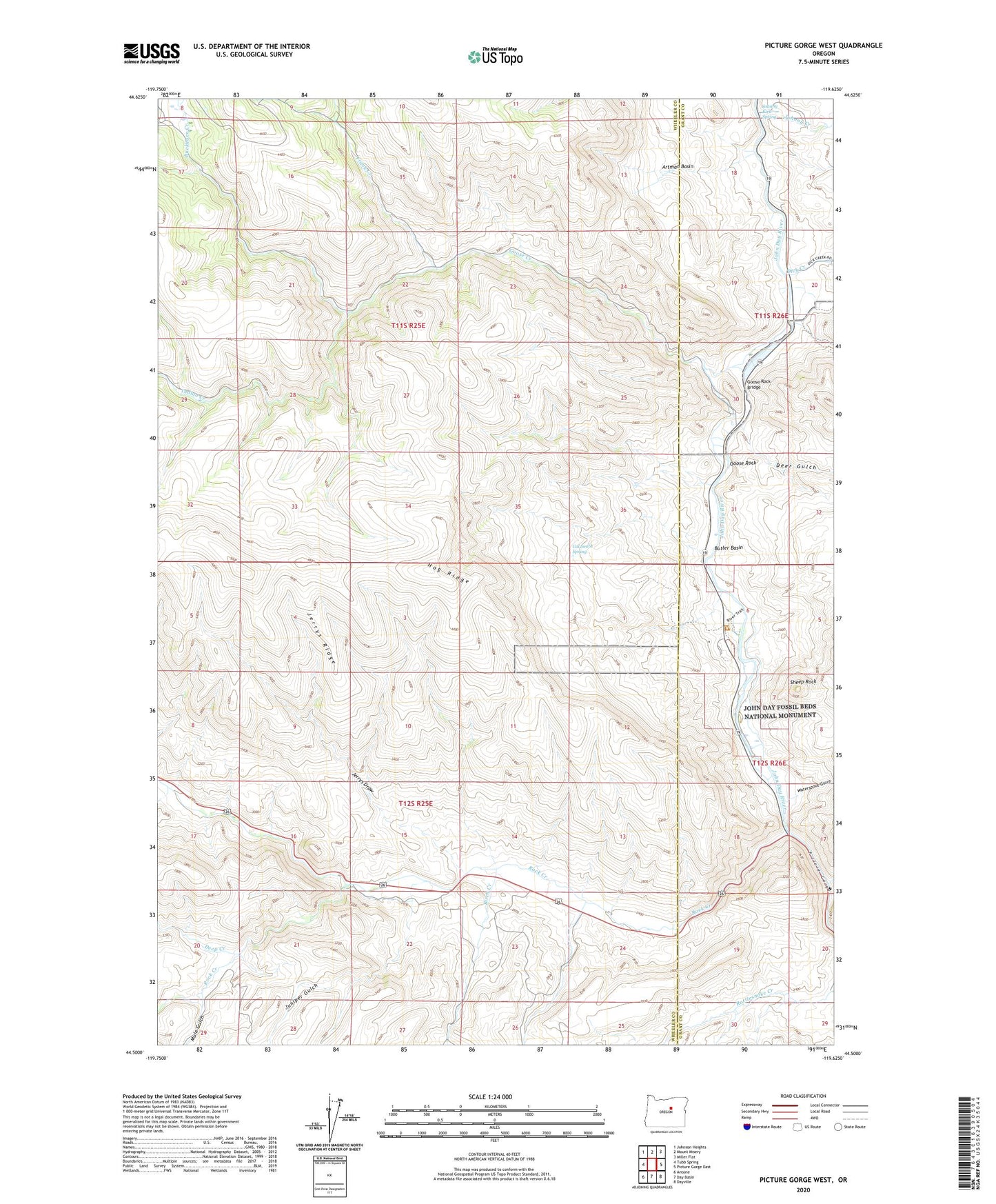
Picture Gorge West Oregon US Topo Map
Couldn't load pickup availability
2023 topographic map quadrangle Picture Gorge West in the state of Oregon. Scale: 1:24000. Based on the newly updated USGS 7.5' US Topo map series, this map is in the following counties: Wheeler, Grant. The map contains contour data, water features, and other items you are used to seeing on USGS maps, but also has updated roads and other features. This is the next generation of topographic maps. Printed on high-quality waterproof paper with UV fade-resistant inks.
Quads adjacent to this one:
West: Tubb Spring
Northwest: Johnson Heights
North: Mount Misery
Northeast: Miller Flat
East: Picture Gorge East
Southeast: Dayville
South: Day Basin
Southwest: Antone
This map covers the same area as the classic USGS quad with code o44119e6.
Contains the following named places: Artman Basin, Birch Creek, Buckhorn Creek, Butler Basin, Cal Smith Spring, Deep Creek, Deer Gulch, Dick Creek, Frank Creek, Goose Creek, Goose Rock, Goose Rock Bridge, Hog Ridge, Humphrey Ranch, Indian Creek, Jerrys Draw, Jerrys Ridge, John Day Fossil Beds National Monument, John Day Fossil Beds National Monument Cant Ranch Museum, Johnny Creek, Johnny Kirk Spring, Juniper Gulch, Little Rattlesnake Creek, Lone Pine Trail, Mountain Creek, Mule Gulch, National Park Service John Day Fossil Beds National Monument Ranger Station, Old Armunger Cabin, Old Buckhorn Ranch, Old Johnson Cabin, Picture Gorge, Rock Creek, Sheep Rock, Thomas Condon Paleontology Center, Tri-Creek Ranch, Waterspout Gulch