MyTopo
Pinhead Buttes Oregon US Topo Map
Couldn't load pickup availability
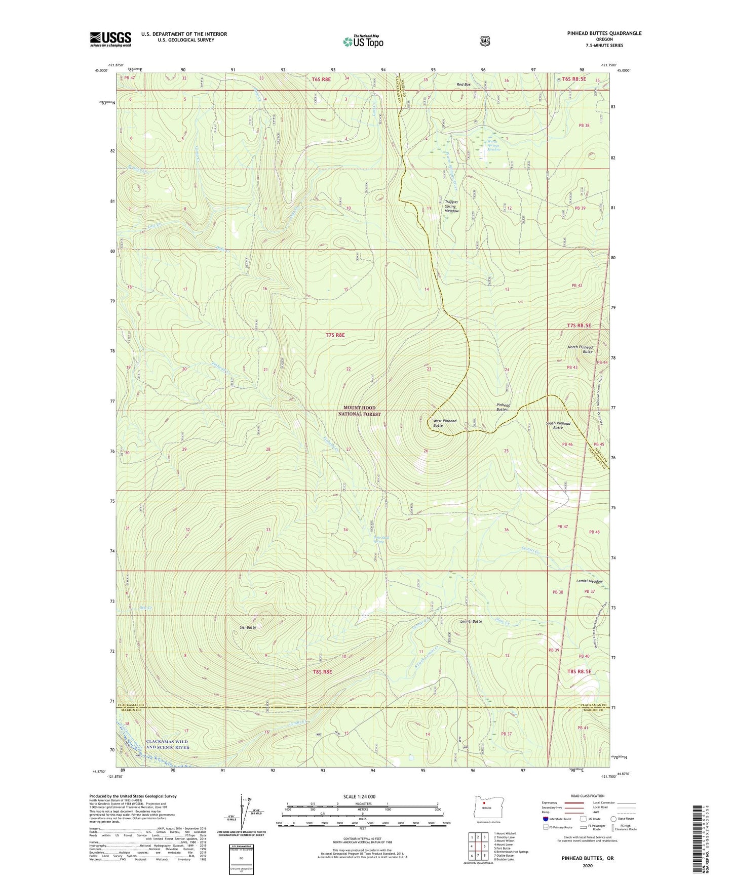
2020 topographic map quadrangle Pinhead Buttes in the state of Oregon. Scale: 1:24000. Based on the newly updated USGS 7.5' US Topo map series, this map is in the following counties: Clackamas, Wasco, Marion. The map contains contour data, water features, and other items you are used to seeing on USGS maps, but also has updated roads and other features. This is the next generation of topographic maps. Printed on high-quality waterproof paper with UV fade-resistant inks.
Quads adjacent to this one:
West: Mount Lowe
Northwest: Mount Mitchell
North: Timothy Lake
Northeast: Mount Wilson
East: Fort Butte
Southeast: Boulder Lake
South: Olallie Butte
Southwest: Breitenbush Hot Springs
Contains the following named places: Bear Skull Spring, Boundary Trail, Camp Creek, Clackamas Wilderness, Dyke Creek, Fall Creek, Fire Springs Trail, Lemiti Butte, Lemiti Campground, Lemiti Meadow, Lemiti Pit, Lostine Pit, North Pinhead Butte, Pinhead Buttes, Poop Creek, Red Box, Sisi Butte, Slow Creek, South Fork Lemiti Creek, South Pinhead Butte, Trapper Spring Meadow, Warm Springs Cabin, Warm Springs Meadow, Warm Springs Quarry, West Pinhead Butte